|
|
Weather Alert |
| Chatham County, NC | |||||||||
|
|
||||||||
|
Canceled 7/23/24 11:00 PM Special Weather Statement issued July 23 at 10:03PM EDT by NWS Raleigh NC At 1003 PM EDT, Doppler radar was tracking strong thunderstorms along a line extending from 8 miles southeast of Thomasville to near Seagrove to 7 miles southeast of Troy. Movement was northeast at 30 mph. HAZARD...Wind gusts up to 45 mph. SOURCE...Radar indicated. IMPACT...Gusty winds could knock down tree limbs and blow around unsecured objects. Locations impacted include... Greensboro, High Point, Burlington, Asheboro, Randleman, Troy, Carthage, Siler City, North Carolina Zoo, and Biscoe. 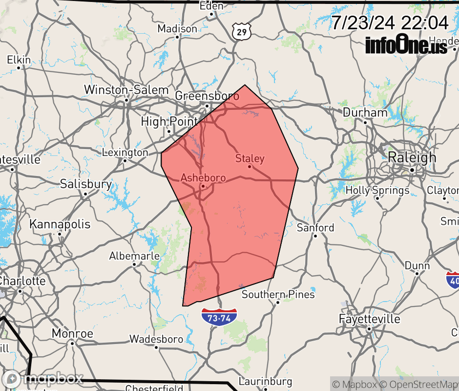 |
|||||||||
 Why aren't you using the InfoOne app? Why aren't you using the InfoOne app?
Stay abreast of information affecting your community! InfoOne tracks real-time information such as:
InfoOne currently supports over 100 communities in NC, VA and WV, and our coverage area is steadily growing. It's free! Install the InfoOne app today and see what you've been missing. |
|||||||||