|
|
Weather Alert |
| Belmont County, OH | |||||||||
|
|
||||||||
|
Canceled 5/30/25 7:13 PM Flash Flood Warning issued May 30 at 6:15PM EDT until May 30 at 9:15PM EDT by NWS Pittsburgh PA FFWPBZ The National Weather Service in Pittsburgh has issued a * Flash Flood Warning for... Eastern Belmont County in east central Ohio... Northeastern Monroe County in east central Ohio... Marshall County in northern West Virginia... Ohio County in northern West Virginia... Northwestern Wetzel County in northern West Virginia... * Until 915 PM EDT. * At 615 PM EDT, Doppler radar indicated thunderstorms producing heavy rain across the warned area. Between 0.5 and 1 inch of rain has fallen. The expected rainfall rate is 0.5 to 1.5 inches in 2 hours. Flash flooding is ongoing or expected to begin shortly. HAZARD...Flash flooding caused by thunderstorms. SOURCE...Radar indicated. IMPACT...Flash flooding of small creeks and streams, urban areas, highways, streets and underpasses as well as other poor drainage and low-lying areas. * Some locations that will experience flash flooding include... Wheeling, Moundsville, Martins Ferry, New Martinsville, St. Clairsville, Bellaire, Warwood, Bethlehem, Triadelphia, Clearview, Valley Grove, Shadyside, McMechen, Powhatan Point, Glen Dale, Cameron, Bridgeport, Benwood, Yorkville and Brookside. 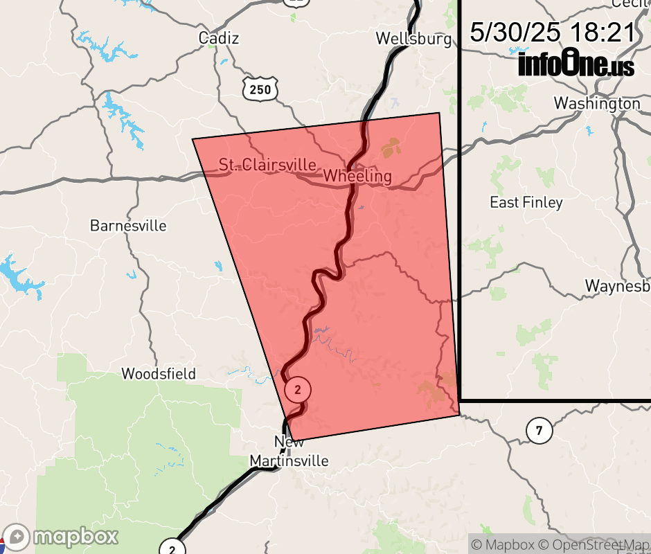 |
|||||||||
 Why aren't you using the InfoOne app? Why aren't you using the InfoOne app?
Stay abreast of information affecting your community! InfoOne tracks real-time information such as:
InfoOne currently supports over 100 communities in NC, VA and WV, and our coverage area is steadily growing. It's free! Install the InfoOne app today and see what you've been missing. |
|||||||||