|
|
Weather Alert |
| Orange County, NC | |||||||||
|
|
||||||||
|
Canceled 8/6/25 5:57 AM Flash Flood Warning issued August 6 at 4:39AM EDT until August 6 at 7:45AM EDT by NWS Raleigh NC FFWRAH The National Weather Service in Raleigh has issued a * Flash Flood Warning for... Durham County in central North Carolina... Southern Orange County in central North Carolina... * Until 745 AM EDT. * At 439 AM EDT, Doppler radar and automated rain gauges indicated thunderstorms producing heavy rain across the warned area. Between 1 and 2 inches of rain have fallen. The expected rainfall rate is 1 to 1.5 inches in 1 hour. Additional rainfall amounts of 1 to 2 inches are possible in the warned area. Flash flooding is ongoing or expected to begin shortly. HAZARD...Flash flooding caused by thunderstorms. SOURCE...Radar and automated gauges. IMPACT...Flash flooding of small creeks and streams, urban areas, highways, streets and underpasses as well as other poor drainage and low-lying areas. * Some locations that will experience flash flooding include... Durham, Chapel Hill, Hillsborough, Carrboro, Butner, Eno River State Park, Parkwood, Bethesda, Efland, Gorman, Jordan Lake, Cane Creek Reservoir and Falls Lake. This includes the following flood prone locations... Morgan Creek at Mason Farm Rd, Booker Creek and Willow Dr, Fordham Rams Place and Ephesus Church Rd, Fordham Bypass Lane by S. Elliot Rd., Rippling Stream Rd along Eno River, University between Durham-Chapel Hill Blvd and Forest Hills, Stagecoach Rd, Old Oxford Rd near Dearborn Drive, Danube Ln Between Meriwether Dr and Thelma St and Morehead Ave at Rex St. 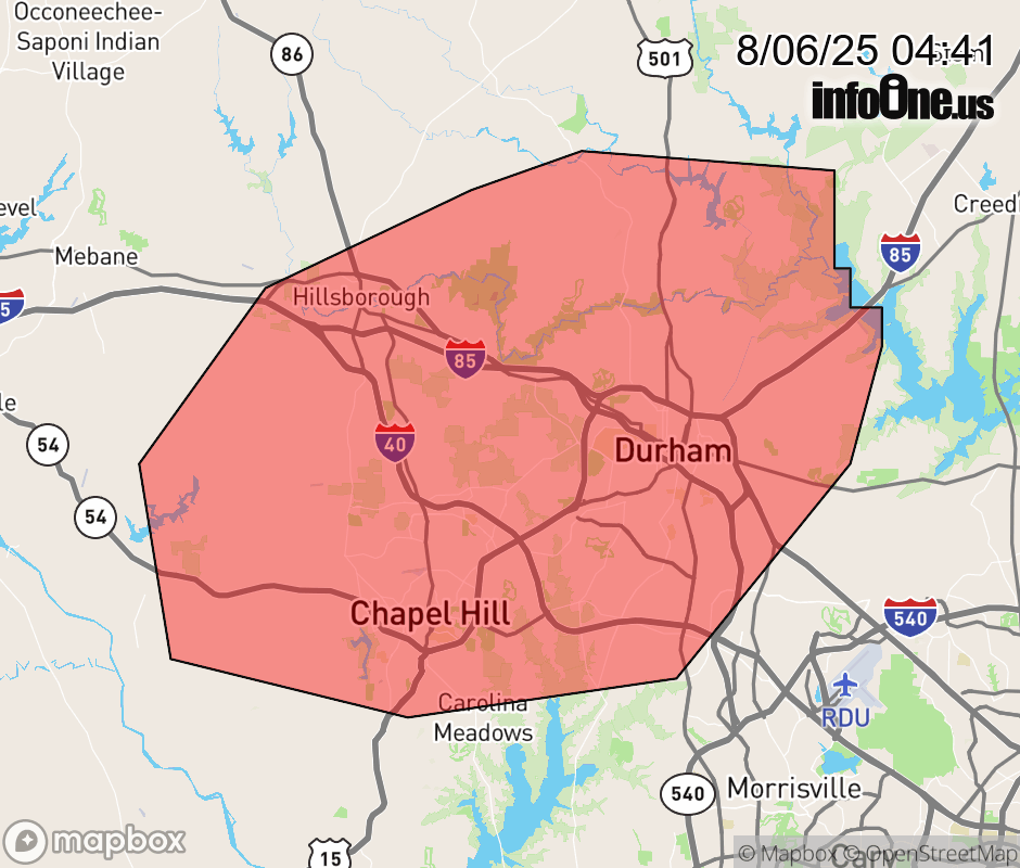 |
|||||||||
 Why aren't you using the InfoOne app? Why aren't you using the InfoOne app?
Stay abreast of information affecting your community! InfoOne tracks real-time information such as:
InfoOne currently supports over 100 communities in NC, VA and WV, and our coverage area is steadily growing. It's free! Install the InfoOne app today and see what you've been missing. |
|||||||||