|
|
Weather Alert |
| Page County, VA | |||||||||
|
|
||||||||
|
Canceled 5/30/25 6:26 PM Tornado Warning issued May 30 at 6:09PM EDT until May 30 at 6:30PM EDT by NWS Baltimore MD/Washington DC At 609 PM EDT, a severe thunderstorm capable of producing a tornado was located near Luray, or 9 miles southeast of Woodstock, moving east at 40 mph. HAZARD...Tornado. SOURCE...Radar indicated rotation. IMPACT...For those in the direct path of a tornado touchdown, flying debris will be dangerous to those caught without shelter. Damage to roofs, siding, and windows may occur. Mobile homes may be damaged or destroyed. Tree damage is likely. This tornadic thunderstorm will remain over mainly rural areas of east central Shenandoah, southwestern Warren, northeastern Page and west central Rappahannock Counties, including the following locations... Fairview, Kimball, Bentonville, Kings Crossing, Compton, Fourway, and Rileyville. 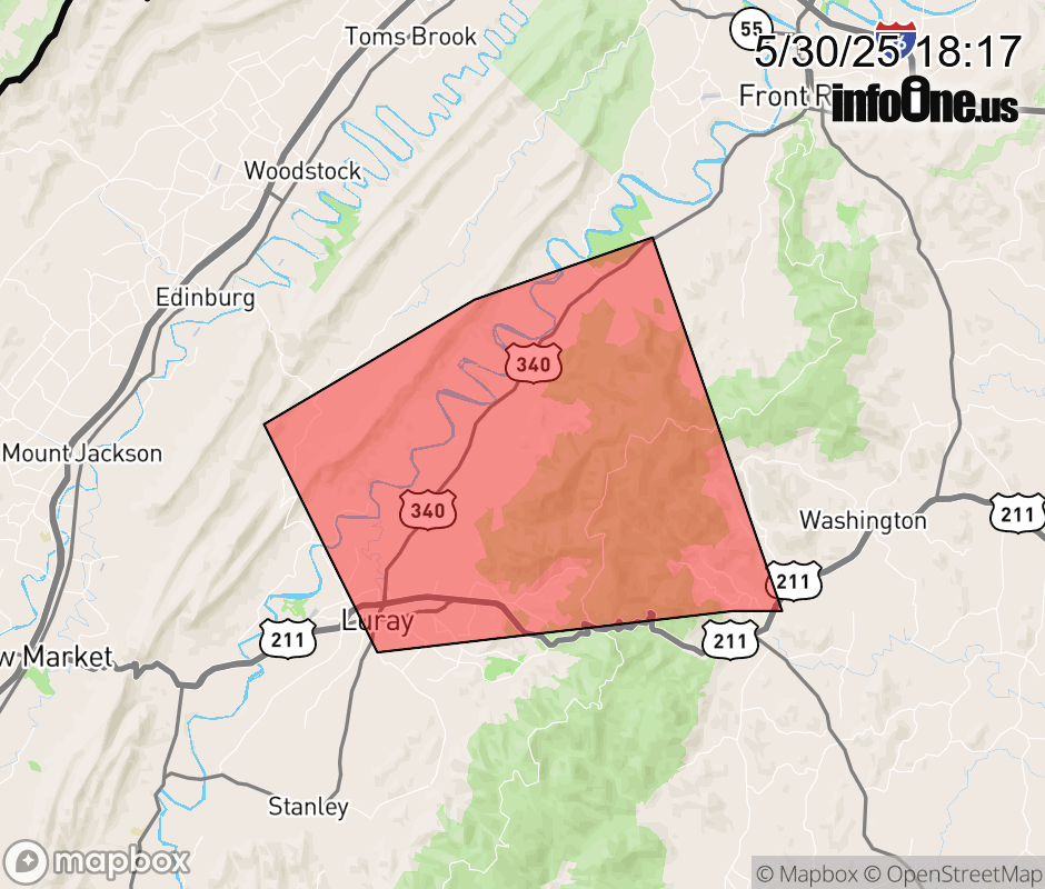 |
|||||||||
 Why aren't you using the InfoOne app? Why aren't you using the InfoOne app?
Stay abreast of information affecting your community! InfoOne tracks real-time information such as:
InfoOne currently supports over 100 communities in NC, VA and WV, and our coverage area is steadily growing. It's free! Install the InfoOne app today and see what you've been missing. |
|||||||||