|
|
Weather Alert |
| Jackson County, WV | |||||||||
|
|
||||||||
|
Canceled 6/18/26 5:45 AM Severe Thunderstorm Warning issued June 18 at 5:14AM EDT until June 18 at 5:45AM EDT by NWS Charleston WV SVRRLX The National Weather Service in Charleston West Virginia has issued a * Severe Thunderstorm Warning for... Meigs County in southeastern Ohio... Northeastern Gallia County in southeastern Ohio... Southwestern Washington County in southeastern Ohio... Northeastern Jackson County in southeastern Ohio... Southeastern Vinton County in southeastern Ohio... Southern Athens County in southeastern Ohio... North central Mason County in western West Virginia... Northeastern Jackson County in northwestern West Virginia... Southwestern Wood County in northwestern West Virginia... * Until 545 AM EDT. * At 514 AM EDT, a severe thunderstorm was located 7 miles northwest of Rutland, moving east at 55 mph. HAZARD...60 mph wind gusts. SOURCE...Radar indicated. IMPACT...Expect damage to roofs, siding, and trees. * Locations impacted include... Pomeroy, Mcarthur, Albany, Coolville, Rutland, Forked Run State Park, New Haven, Mason, Washington, Tuppers Plains, Lubeck, Middleport, Chester, Syracuse, Hartford City, Vinton, Wilkesville, Portland, Radcliffe, and Reedsville. This includes the following highways... Interstate 77 in West Virginia between mile markers 151 and 160. Route 50 in West Virginia between mile markers 1 and 2. 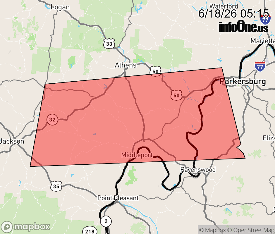 |
|||||||||
 Why aren't you using the InfoOne app? Why aren't you using the InfoOne app?
Stay abreast of information affecting your community! InfoOne tracks real-time information such as:
InfoOne currently supports over 100 communities in NC, VA and WV, and our coverage area is steadily growing. It's free! Install the InfoOne app today and see what you've been missing. |
|||||||||