
|
Weather Alert |
| Morgan County, WV | |||||||||
|
|
||||||||
|
Canceled 8/10/26 2:53 PM Severe Thunderstorm Warning issued August 10 at 2:30PM EDT until August 10 at 3:00PM EDT by NWS Baltimore MD/Washington DC At 229 PM EDT, a severe thunderstorm was located near Berkeley Springs, or 8 miles northeast of Paw Paw, moving east at 20 mph. THIS IS A DESTRUCTIVE STORM FOR NORTHERN MORGAN COUNTY NEAR BERKELEY SPRINGS. HAZARD...80 mph wind gusts and golf ball size hail. SOURCE...Radar indicated. IMPACT...Expect considerable damage to trees and power lines. Your life is at significant risk if outdoors. In addition to some trees falling into homes, wind damage is possible to roofs, sheds, open garages, and mobile homes. Locations impacted include... Berkeley Springs, Great Cacapon, Little Orleans, Johnsons Mill, Lineburg, Valley View, Spohrs Crossroads, Rock Gap, Stotlers Crossroads, Highland Ridge, Smith Crossroads, Berryville, New Hope, and Shady Grove. 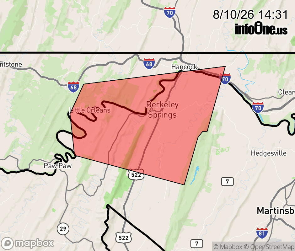 |
|||||||||
 Why aren't you using the InfoOne app? Why aren't you using the InfoOne app?
Stay abreast of information affecting your community! InfoOne tracks real-time information such as:
InfoOne currently supports over 100 communities in NC, VA and WV, and our coverage area is steadily growing. It's free! Install the InfoOne app today and see what you've been missing. |
|||||||||