|
|
Weather Alert |
| Franklin County, OH | |||||||||
|
|
||||||||
|
Canceled 9/21/22 3:00 AM Special Weather Statement issued September 21 at 2:25AM EDT by NWS Wilmington OH At 224 AM EDT, strong thunderstorms were located along a line extending from near Richwood to Wapakoneta, moving southeast at 65 mph. HAZARD...Wind gusts up to 40 mph, pea size hail, frequent cloud-to-ground lightning, and very heavy rain. SOURCE...Radar indicated. IMPACT...Gusty winds could knock down tree limbs and blow around unsecured objects. Hail may cause minor damage to outdoor objects. Lightning can cause serious injury or death. Visibility will be poor and hydroplaning is possible. Locations impacted include... Columbus, Dublin, Westerville, Delaware, Gahanna, Marysville, Sidney, Worthington, Bellefontaine, Wapakoneta, St. Marys, Powell, Sunbury, Plain City, Richwood, West Liberty, Anna, North Lewisburg, Jackson Center and Russells Point. 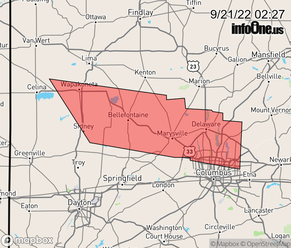 |
|||||||||
 Why aren't you using the InfoOne app? Why aren't you using the InfoOne app?
Stay abreast of information affecting your community! InfoOne tracks real-time information such as:
InfoOne currently supports over 100 communities in NC, VA and WV, and our coverage area is steadily growing. It's free! Install the InfoOne app today and see what you've been missing. |
|||||||||