|
|
Weather Alert |
| Franklin County, OH | |||||||||
|
|
||||||||
|
Canceled 5/21/22 3:24 PM Severe Thunderstorm Warning issued May 21 at 2:57PM EDT until May 21 at 3:45PM EDT by NWS Wilmington OH The National Weather Service in Wilmington has issued a * Severe Thunderstorm Warning for... Southern Franklin County in central Ohio... Northwestern Pickaway County in central Ohio... Southeastern Madison County in central Ohio... * Until 345 PM EDT. * At 257 PM EDT, a severe thunderstorm was located near Mount Sterling, moving northeast at 20 mph. HAZARD...60 mph wind gusts and quarter size hail. SOURCE...Radar indicated. IMPACT...Minor hail damage to vehicles is possible. Expect wind damage to trees and power lines. * Locations impacted include... Columbus, Grove City, Upper Arlington, Bexley, Canal Winchester, Groveport, Mount Sterling, Ohio State University, Grandview Heights, Obetz, Commercial Point, Lithopolis, Urbancrest, Valleyview, Marble Cliff, Harrisburg, Orient, Lockbourne, Chenoweth and Georgesville. This includes the following Interstates... I-70 in Ohio between mile markers 92 and 105. I-71 in Ohio between mile markers 81 and 111. 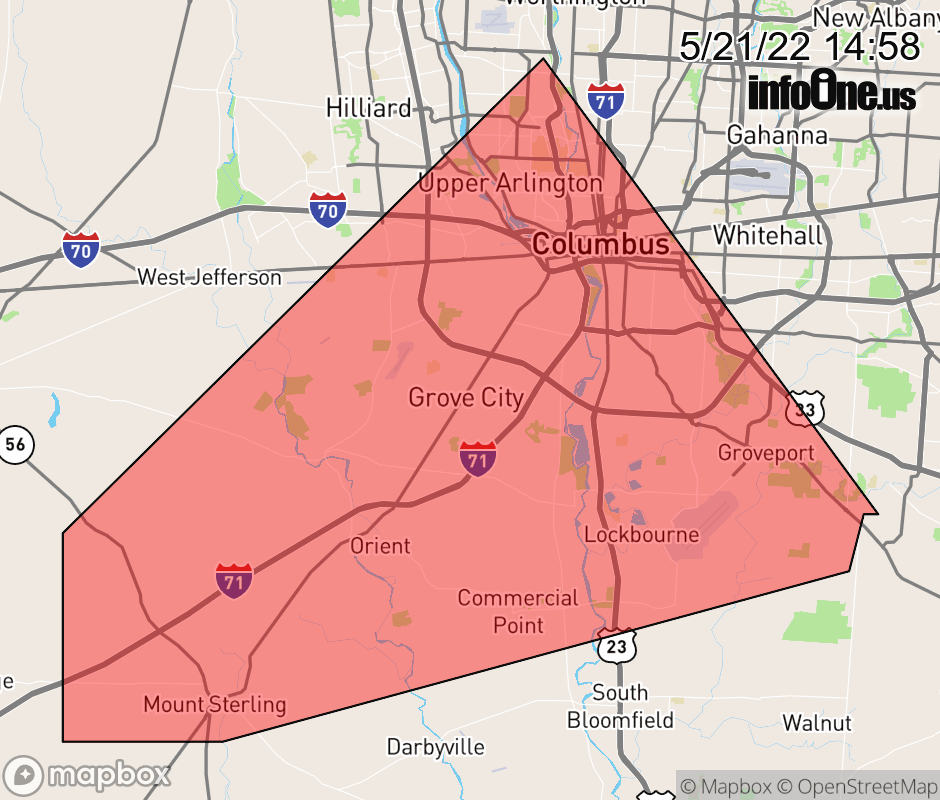 |
|||||||||
 Why aren't you using the InfoOne app? Why aren't you using the InfoOne app?
Stay abreast of information affecting your community! InfoOne tracks real-time information such as:
InfoOne currently supports over 100 communities in NC, VA and WV, and our coverage area is steadily growing. It's free! Install the InfoOne app today and see what you've been missing. |
|||||||||