|
|
Weather Alert |
| Yancey County, NC | |||||||||
|
|
||||||||
|
Canceled 1/17/26 1:00 AM Special Weather Statement issued January 16 at 2:04PM EST by NWS Greenville-Spartanburg SC A band of precipitation is expected cross the mountains of the Carolinas and northeast Georgia overnight tonight. The precipitation will likely start out as a mix of snow, sleet, and freezing rain, but mostly change over to all snow above 3500 ft and rain with patchy freezing rain in the valleys, before tapering off around daybreak Saturday. With temperatures hovering in the upper 20s to lower 30s, minor snow accumulations of 1 to 3 inches will be possible in the highest elevations, with spotty light ice accretions, mainly on elevated surfaces, in the valleys and near the Blue Ridge Escarpment. Clearing skies should allow temperatures to warm above freezing and thaw out most roads by midday Saturday. 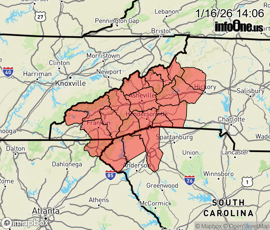 |
|||||||||
 Why aren't you using the InfoOne app? Why aren't you using the InfoOne app?
Stay abreast of information affecting your community! InfoOne tracks real-time information such as:
InfoOne currently supports over 100 communities in NC, VA and WV, and our coverage area is steadily growing. It's free! Install the InfoOne app today and see what you've been missing. |
|||||||||