|
|
Weather Alert |
| Warren County, VA | |||||||||
|
|
||||||||
|
Canceled 6/30/26 2:26 PM Heat Advisory issued June 30 at 10:06AM EDT until July 1 at 8:00PM EDT by NWS Baltimore MD/Washington DC * WHAT... For the Heat Advisory, heat index values up to 104 expected. For the Extreme Heat Watch, dangerously hot conditions with heat index values up to 108 possible. * WHERE... In Maryland, Washington County. In Virginia, Clarke, Frederick, Page, Shenandoah, and Warren Counties. In West Virginia, Berkeley, Jefferson, and Morgan Counties. * WHEN... For the Heat Advisory, from 11 AM to 8 PM EDT Wednesday. For the Extreme Heat Watch, from Thursday morning through Friday evening. * IMPACTS... Heat related illnesses increase significantly during extreme heat and high humidity events. Hot temperatures and high humidity may cause heat illnesses. 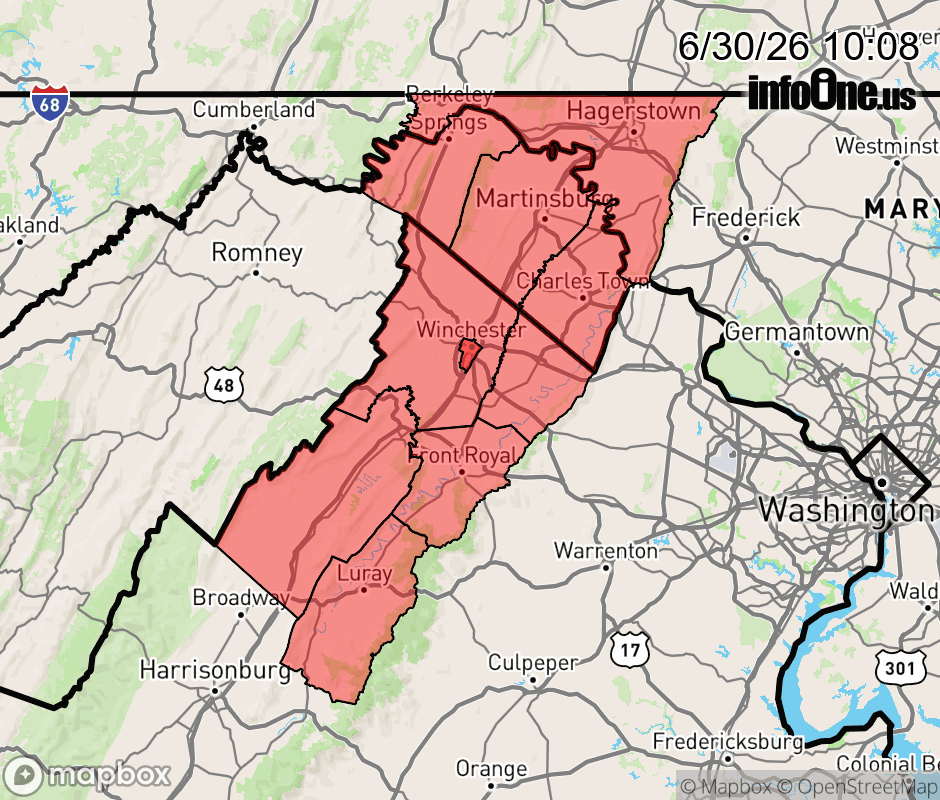 |
|||||||||
 Why aren't you using the InfoOne app? Why aren't you using the InfoOne app?
Stay abreast of information affecting your community! InfoOne tracks real-time information such as:
InfoOne currently supports over 100 communities in NC, VA and WV, and our coverage area is steadily growing. It's free! Install the InfoOne app today and see what you've been missing. |
|||||||||