|
|
Weather Alert |
| Wayne County, WV | |||||||||
|
|
||||||||
|
Canceled 6/10/26 9:30 AM Special Weather Statement issued June 10 at 8:23AM EDT by NWS Charleston WV At 820 AM EDT, Doppler radar was tracking a cluster of strong thunderstorms producing heavy rain along a line extending from near Camp Dix to Chapmanville. Movement was southeast at 30 mph. HAZARD...A quick 1 to 2 inches of rain. SOURCE...Radar indicated. IMPACT...Flooding of poor drainage and low-lying areas along with reduced visibility. The morning commute will be impacted. Locations impacted include... Grayson, Madison, Louisa, Logan, Olive Hill, Wayne, Beech Fork State Park, Rush, Yatesville Lake State Park, Chapmanville, and Fort Gay This includes the following highways... Interstate 64 in Kentucky between mile markers 152 and 187. Route 119 between mile markers 27 and 59. 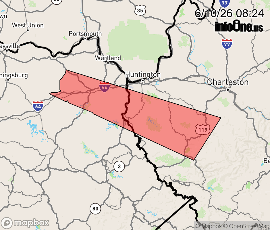 |
|||||||||
 Why aren't you using the InfoOne app? Why aren't you using the InfoOne app?
Stay abreast of information affecting your community! InfoOne tracks real-time information such as:
InfoOne currently supports over 100 communities in NC, VA and WV, and our coverage area is steadily growing. It's free! Install the InfoOne app today and see what you've been missing. |
|||||||||