|
|
Weather Alert |
| Portage County, OH | |||||||||
|
|
||||||||
|
Canceled 3/26/26 7:45 PM Severe Thunderstorm Warning issued March 26 at 7:16PM EDT until March 26 at 7:45PM EDT by NWS Cleveland OH At 715 PM EDT, a severe thunderstorm was located 8 miles southwest of Newton Falls, or 9 miles southeast of Ravenna, moving east at 60 mph. HAZARD...60 mph wind gusts and quarter size hail. SOURCE...Radar indicated. IMPACT...Minor damage to vehicles is possible. Expect damage to trees and power lines. Locations impacted include... Atwater, Edinburg, Deerfield, and Wayland. 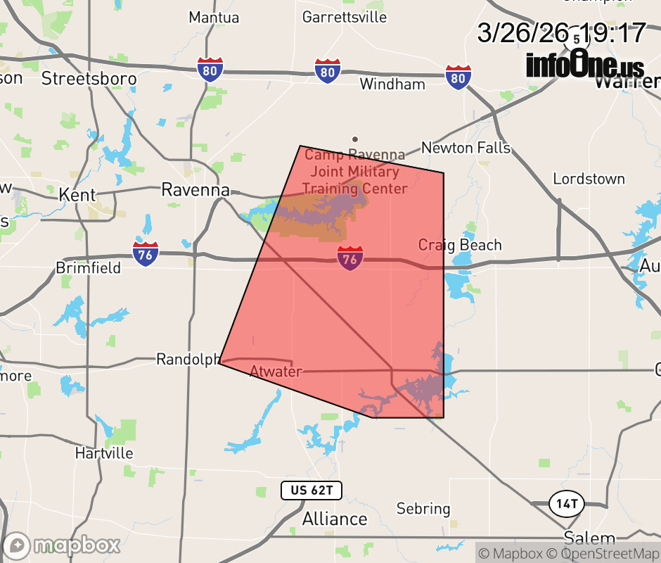 |
|||||||||
 Why aren't you using the InfoOne app? Why aren't you using the InfoOne app?
Stay abreast of information affecting your community! InfoOne tracks real-time information such as:
InfoOne currently supports over 100 communities in NC, VA and WV, and our coverage area is steadily growing. It's free! Install the InfoOne app today and see what you've been missing. |
|||||||||