|
|
Weather Alert |
| Forsyth County, NC | |||||||||
|
|
||||||||
|
Canceled 5/21/22 6:30 PM Severe Thunderstorm Warning issued May 21 at 5:37PM EDT until May 21 at 6:30PM EDT by NWS Raleigh NC The National Weather Service in Raleigh has issued a * Severe Thunderstorm Warning for... Eastern Forsyth County in central North Carolina... Northeastern Davidson County in central North Carolina... Northwestern Guilford County in central North Carolina... * Until 630 PM EDT. * At 537 PM EDT, a severe thunderstorm was located 8 miles northwest of Thomasville, or 9 miles north of Lexington, moving northeast at 20 mph. HAZARD...60 mph wind gusts and penny size hail. SOURCE...Radar indicated. IMPACT...Expect damage to roofs, siding, and trees. * Locations impacted include... Greensboro, Winston-Salem, High Point, Lexington, Thomasville, Kernersville, Stokesdale, Walkertown, Oak Hollow Marina and Belews Creek. 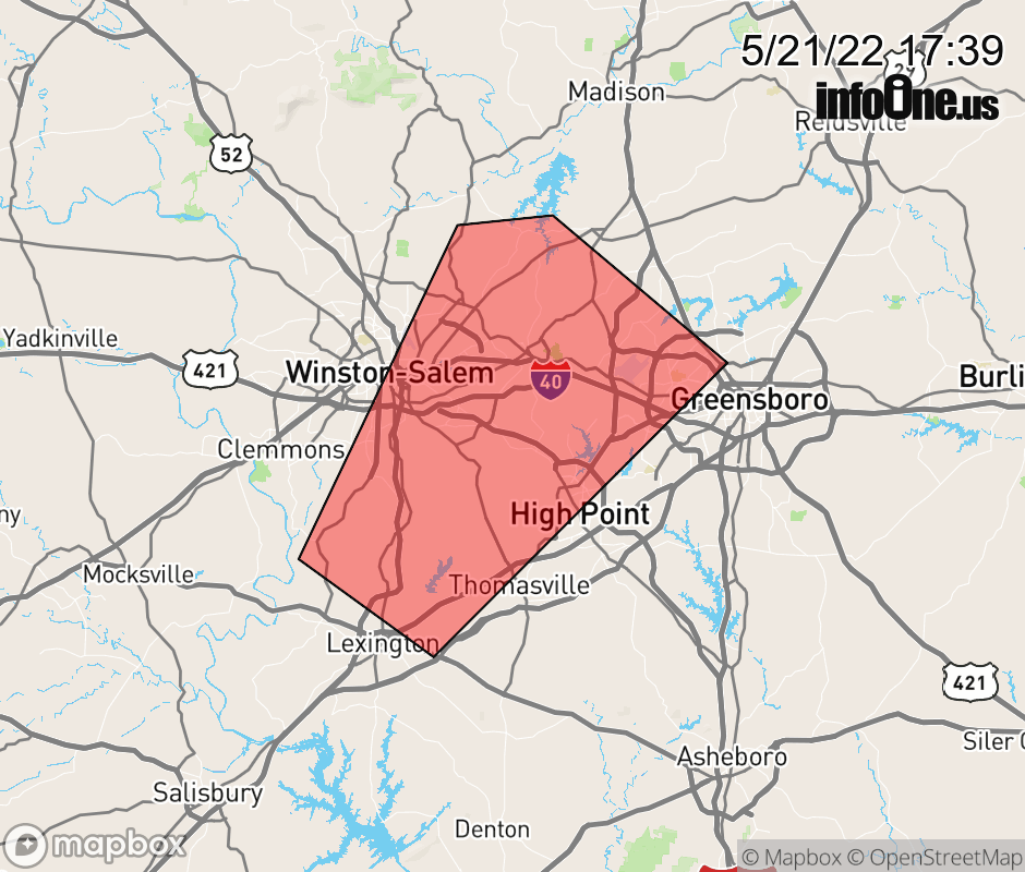 |
|||||||||
 Why aren't you using the InfoOne app? Why aren't you using the InfoOne app?
Stay abreast of information affecting your community! InfoOne tracks real-time information such as:
InfoOne currently supports over 100 communities in NC, VA and WV, and our coverage area is steadily growing. It's free! Install the InfoOne app today and see what you've been missing. |
|||||||||