
|
Weather Alert |
| Raleigh County, WV | |||||||||
|
|
||||||||
|
Canceled 8/2/26 11:46 PM Flash Flood Warning issued August 2 at 9:41PM EDT until August 3 at 12:00AM EDT by NWS Charleston WV At 941 PM EDT, Doppler radar and automated rain gauges indicated thunderstorms producing heavy rain across the warned area. Between 2 and 4 inches of rain have fallen. Additional rainfall amounts of 0.5 to 1 inch are possible in the warned area. Flash flooding is ongoing or expected to begin shortly. HAZARD...Flash flooding caused by thunderstorms. SOURCE...Radar and automated gauges. IMPACT...Flash flooding of small creeks and streams, urban areas, highways, streets and underpasses as well as other poor drainage and low-lying areas. Some locations that will experience flash flooding include... Babcock State Park, Northfork, Shady Spring, Daniels, Beaver, Stanaford, Piney View, Coal City, Meadow Bridge, Keystone, Anawalt, Ghent, Josephine, Herndon and Maybeury. This includes the following highways... Interstate 64 in West Virginia between mile markers 123 and 136. West Virginia Turnpike between mile markers 28 and 38. 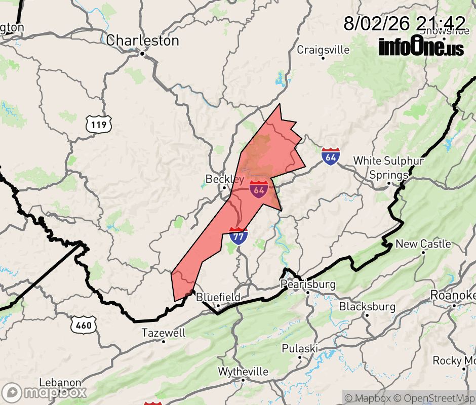 |
|||||||||
 Why aren't you using the InfoOne app? Why aren't you using the InfoOne app?
Stay abreast of information affecting your community! InfoOne tracks real-time information such as:
InfoOne currently supports over 100 communities in NC, VA and WV, and our coverage area is steadily growing. It's free! Install the InfoOne app today and see what you've been missing. |
|||||||||