|
|
Weather Alert |
| Rowan County, NC | |||||||||
|
|
||||||||
|
Winter Storm Watch issued January 21 at 12:37PM EST until January 26 at 1:00PM EST by NWS Greenville-Spartanburg SC * WHAT... Heavy mixed precipitation possible. Total snow and sleet accumulations between 1 and 6 inches and ice accumulations between four tenths and one inch possible. * WHERE... Northeast Georgia, Western North Carolina, and the South Carolina Upstate. * WHEN... From Saturday morning through Monday afternoon. * IMPACTS... Significant ice accumulation on power lines and tree limbs may cause widespread and long-lasting power outages. Ice and snow covered roadways will become treacherous and impassable. Widespread power outages are likely due to the weight of the ice and snow on tree limbs and power lines. The outages could last for days in some areas. The hazardous conditions could impact the Monday morning commute. * ADDITIONAL DETAILS... Highest snow and sleet accumulations are possible north of I-40. Highest ice accumulations are possible across the southern mountains of North Carolina, the mountains of northeast Georgia, and the mountains of South Carolina. 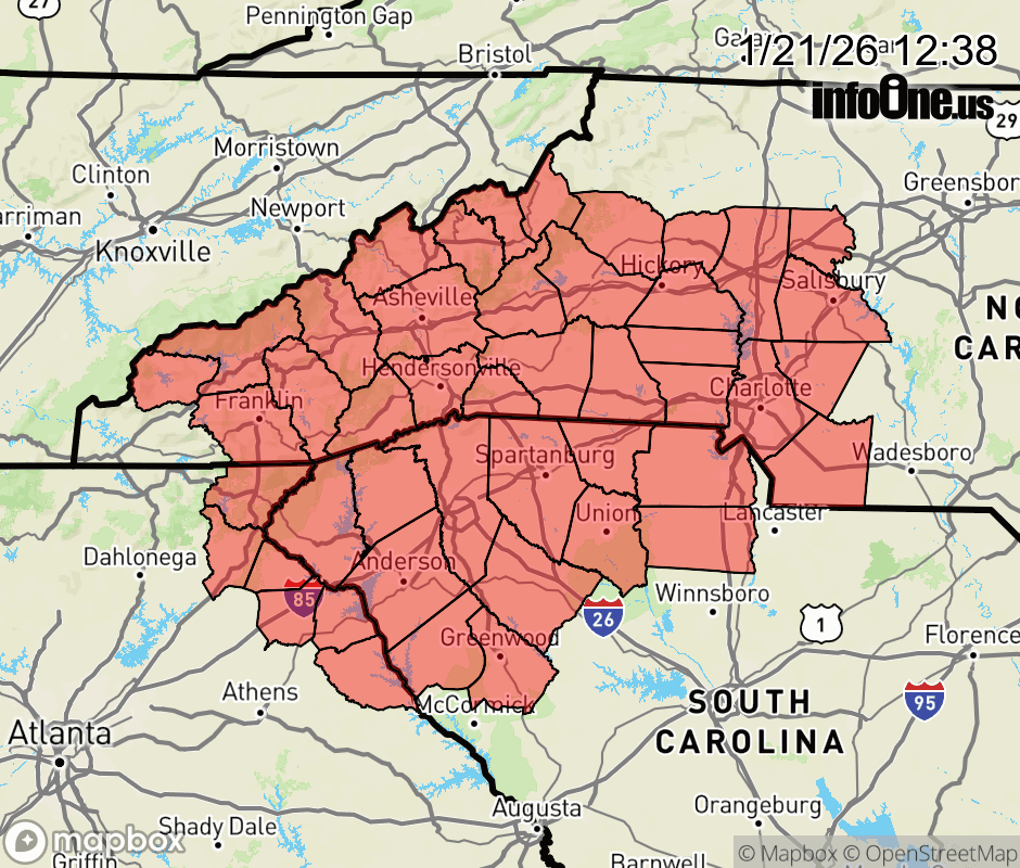 |
|||||||||
 Why aren't you using the InfoOne app? Why aren't you using the InfoOne app?
Stay abreast of information affecting your community! InfoOne tracks real-time information such as:
InfoOne currently supports over 100 communities in NC, VA and WV, and our coverage area is steadily growing. It's free! Install the InfoOne app today and see what you've been missing. |
Is this information important? Please share: Tweet | ||||||||