|
|
Weather Alert |
| Marion County, WV | |||||||||
|
|
||||||||
|
Special Weather Statement issued December 3 at 1:05PM EST by NWS Pittsburgh PA Light snow is expected to develop late tonight ahead of an approaching cold front through the area. This will impact the entire area but mainly the northern counties and the ridges will be impacted the most. The snow is expected to be light with only a coating to 2 inches at the very most. However, the colder temperatures will allow snow to stick to all untreated surfaces. This will make for slippery travel through the morning commute. It doesn't take much snow in these colder temperatures to cause impacts. Motorists should prepare for slick road conditions Thursday morning. Allow extra time for travel. 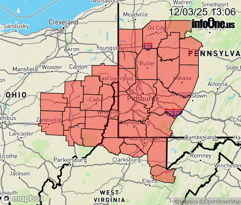 |
|||||||||
 Why aren't you using the InfoOne app? Why aren't you using the InfoOne app?
Stay abreast of information affecting your community! InfoOne tracks real-time information such as:
InfoOne currently supports over 100 communities in NC, VA and WV, and our coverage area is steadily growing. It's free! Install the InfoOne app today and see what you've been missing. |
Is this information important? Please share: Tweet | ||||||||