
|
Weather Alert |
| Buchanan County, VA | |||||||||
|
|
||||||||
|
Canceled 7/11/26 3:58 PM Flash Flood Warning issued July 11 at 1:30PM EDT until July 11 at 5:00PM EDT by NWS Charleston WV FFWRLX The National Weather Service in Charleston has extended the * Flash Flood Warning for... Northern Buchanan County in southwestern Virginia... Central McDowell County in southern West Virginia... * Until 500 PM EDT. * At 130 PM EDT, Doppler radar indicated showers producing heavy rainfall. Between 1 and 2.5 inches of rain have fallen. Additional rainfall amounts up to 0.5 inches are possible in the warned area. Flash flooding is already occurring. HAZARD...Flash flooding caused by thunderstorms. SOURCE...Radar indicated. IMPACT...Flash flooding of small creeks and streams, urban areas, highways, streets and underpasses as well as other poor drainage and low-lying areas. * Some locations that will experience flash flooding include... Gary, War, Bradshaw, Iaeger, Jolo, Avondale, Panther, Coalwood, Stacy, Cucumber, Hurley, Roseann and Elbert. Additional rounds of showers and thunderstorms are developing to the west across eastern Kentucky and will move across the warned area over the next few hours. 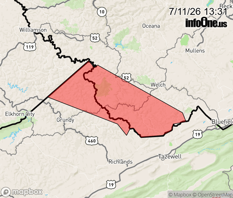 |
|||||||||
 Why aren't you using the InfoOne app? Why aren't you using the InfoOne app?
Stay abreast of information affecting your community! InfoOne tracks real-time information such as:
InfoOne currently supports over 100 communities in NC, VA and WV, and our coverage area is steadily growing. It's free! Install the InfoOne app today and see what you've been missing. |
|||||||||