|
|
Weather Alert |
| Pendleton County, WV | |||||||||
|
|
||||||||
|
Canceled 1/23/26 5:18 PM Winter Storm Warning issued January 23 at 10:03AM EST until January 26 at 10:00AM EST by NWS Baltimore MD/Washington DC * WHAT... Heavy mixed precipitation expected. Total snow and sleet accumulations between 12 and 18 inches and ice accumulations around two tenths of an inch, confined mostly west of the Allegheny Front and south of US-33. Winds gusting as high as 45 mph. * WHERE... Portions of western Maryland, western Virginia, and eastern West Virginia. * WHEN... From 7 PM Saturday to 10 AM EST Monday. * IMPACTS... Travel could be very difficult to impossible. The hazardous conditions could impact the Monday morning commute. Gusty winds could bring down tree branches. * ADDITIONAL DETAILS... Snow will likely overspread the area late Saturday afternoon, becoming heavy at times Saturday night with rates of one to two inches per hour possible at times. A mix with sleet or freezing rain is expected Sunday, especially west of the Allegheny Front. Precipitation is most likely to change back to snow and linger west of the Allegheny Front Sunday night into Monday morning. Visibility of one-quarter mile or less is possible at times. A prolonged period of sub-zero wind chills is likely beginning Friday evening and lasting through the middle of next week. 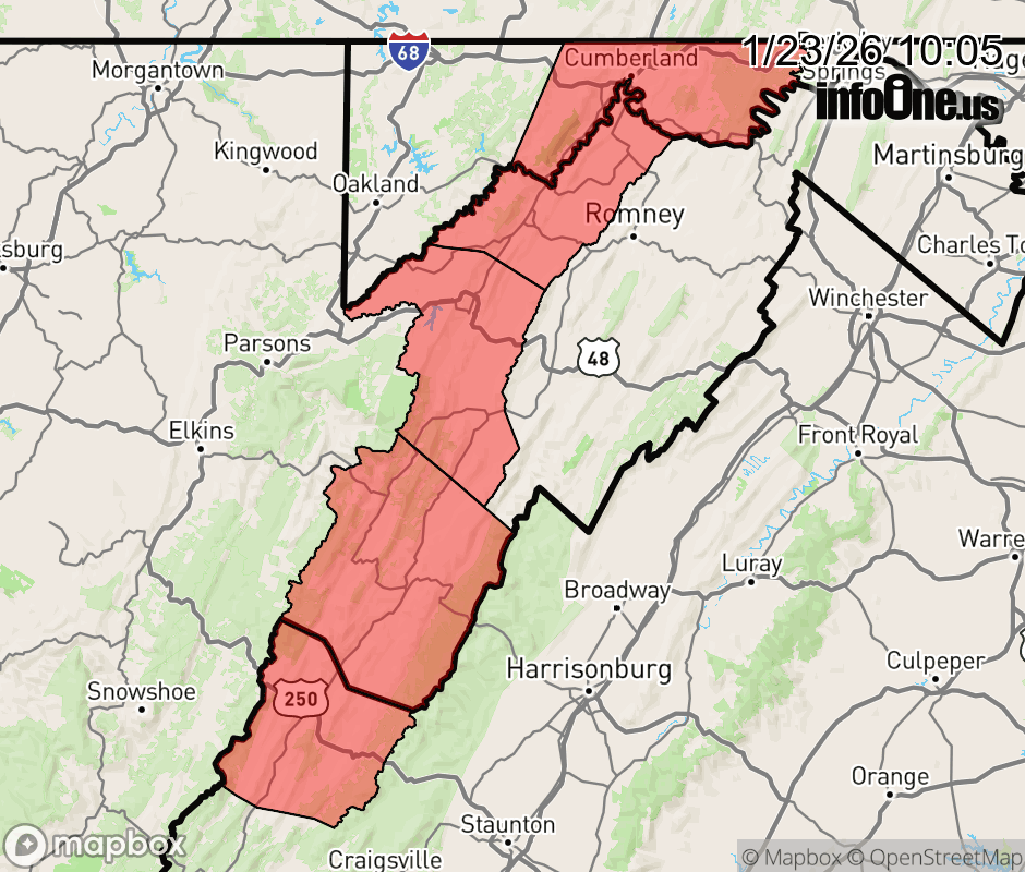 |
|||||||||
 Why aren't you using the InfoOne app? Why aren't you using the InfoOne app?
Stay abreast of information affecting your community! InfoOne tracks real-time information such as:
InfoOne currently supports over 100 communities in NC, VA and WV, and our coverage area is steadily growing. It's free! Install the InfoOne app today and see what you've been missing. |
|||||||||