|
|
Weather Alert |
| McDowell County, NC | |||||||||
|
|
||||||||
|
Special Weather Statement issued November 10 at 8:20AM EST by NWS Greenville-Spartanburg SC Snow showers are expected to increase in coverage across the mountains this afternoon and evening. Snow showers will be most concentrated across the North Carolina counties bordering Tennessee, where a Winter Storm Warning is in effect for the high elevations of Swain County, and Winter Weather Advisories are in effect for the remainder of those counties. However, scattered snow showers are expected to develop east and south of the Tennessee border counties this afternoon into the evening...from around 300 PM through 800 PM. Some of these could produce brief bursts of moderate to heavy snow. Most locations that receive these snow showers will see little-to-no accumulation. However, isolated locations could pick up a quick 1 to 2 inches. The most likely areas to see significant snow accumulations outside of the Advisory and Warning areas will be across northern Buncombe County, including the Weaverville area, and across the high elevations of northern Macon and northern Jackson Counties. If traveling across the area this afternoon, be prepared for sudden deterioration in driving conditions. Slow down and allow for plenty of space between yourself and other vehicles if snow covered roads are encountered. 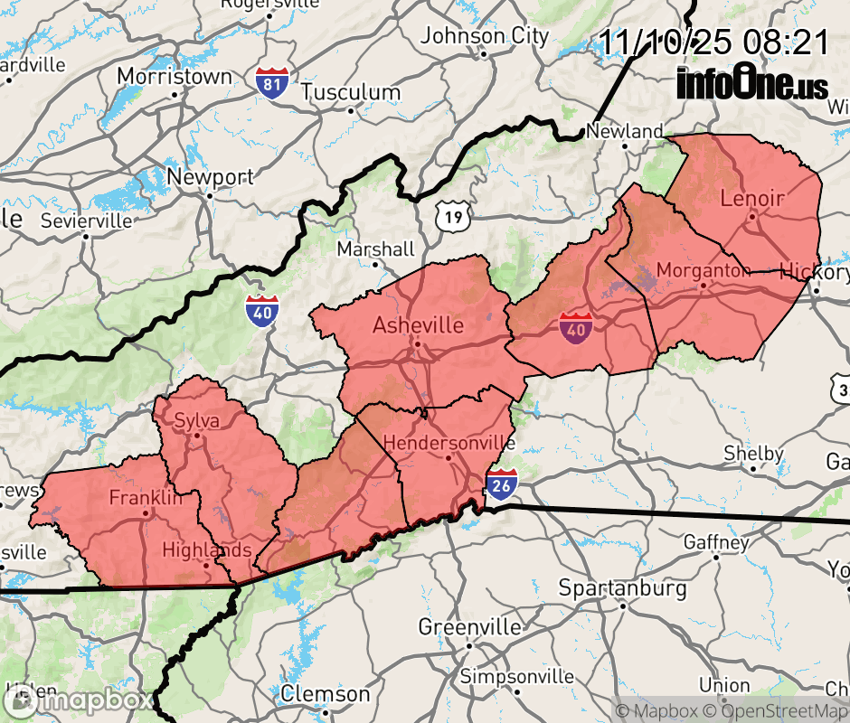 |
|||||||||
 Why aren't you using the InfoOne app? Why aren't you using the InfoOne app?
Stay abreast of information affecting your community! InfoOne tracks real-time information such as:
InfoOne currently supports over 100 communities in NC, VA and WV, and our coverage area is steadily growing. It's free! Install the InfoOne app today and see what you've been missing. |
Is this information important? Please share: Tweet | ||||||||