|
|
Weather Alert |
| Guilford County, NC | |||||||||
|
|
||||||||
|
Canceled 6/16/25 5:53 PM Flash Flood Warning issued June 16 at 5:11PM EDT until June 16 at 8:15PM EDT by NWS Raleigh NC FFWRAH The National Weather Service in Raleigh has issued a * Flash Flood Warning for... Central Guilford County in central North Carolina... * Until 815 PM EDT. * At 511 PM EDT, Doppler radar indicated thunderstorms producing heavy rain across the warned area. Between 1 and 2 inches of rain have fallen. Additional rainfall amounts of 1 to 2 inches are possible in the warned area. Flash flooding is ongoing or expected to begin shortly. HAZARD...Life threatening flash flooding. Thunderstorms producing flash flooding. SOURCE...Radar. IMPACT...Life threatening flash flooding of creeks and streams, urban areas, highways, streets and underpasses. * Some locations that will experience flash flooding include... Greensboro, High Point, McLeansville, Summerfield, Stokesdale, Pleasant Garden, Jamestown, Lake Jeanette Marina, Lake Brandt, Lake Townsend, Lake Townsend Marina, Haw River State Park, Monticello, Forest Oaks and Colfax. 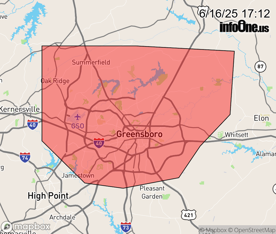 |
|||||||||
 Why aren't you using the InfoOne app? Why aren't you using the InfoOne app?
Stay abreast of information affecting your community! InfoOne tracks real-time information such as:
InfoOne currently supports over 100 communities in NC, VA and WV, and our coverage area is steadily growing. It's free! Install the InfoOne app today and see what you've been missing. |
|||||||||