|
|
Weather Alert |
| Columbiana County, OH | |||||||||
|
|
||||||||
|
Canceled 6/18/25 9:35 PM Severe Thunderstorm Warning issued June 18 at 9:17PM EDT until June 18 at 10:15PM EDT by NWS Pittsburgh PA SVRPBZ The National Weather Service in Pittsburgh has issued a * Severe Thunderstorm Warning for... Northwestern Belmont County in east central Ohio... Carroll County in east central Ohio... Northwestern Columbiana County in east central Ohio... Eastern Coshocton County in east central Ohio... Guernsey County in east central Ohio... Western Harrison County in east central Ohio... Eastern Muskingum County in east central Ohio... Western Noble County in east central Ohio... Tuscarawas County in east central Ohio... * Until 1015 PM EDT. * At 917 PM EDT, severe thunderstorms were located along a line from 18 miles northwest of Sugarcreek to 28 miles southwest of South Zanesville, or along a line from 22 miles northwest of Dover to 30 miles southwest of Zanesville, moving east at 40 mph. HAZARD...60 mph wind gusts. SOURCE...Radar indicated. IMPACT...Expect damage to roofs, siding, and trees. * Locations impacted include... Zanesville, New Philadelphia, Dover, Coshocton, Cambridge, Uhrichsville, Carrollton, Caldwell, Freeport, Newcomerstown, Dennison, Strasburg, New Concord, Byesville, West Lafayette, Sugarcreek, Augusta, Gnadenhutten, Antrim and Malvern. These storms have had a history of producing wind damage across central Ohio. 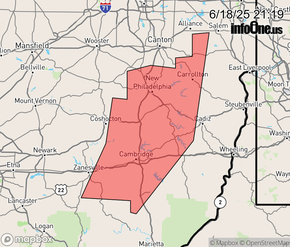 |
|||||||||
 Why aren't you using the InfoOne app? Why aren't you using the InfoOne app?
Stay abreast of information affecting your community! InfoOne tracks real-time information such as:
InfoOne currently supports over 100 communities in NC, VA and WV, and our coverage area is steadily growing. It's free! Install the InfoOne app today and see what you've been missing. |
|||||||||