|
|
Weather Alert |
| Montgomery County, NC | |||||||||
|
|
||||||||
|
Canceled 5/23/22 2:53 PM Severe Thunderstorm Warning issued May 23 at 2:26PM EDT until May 23 at 3:30PM EDT by NWS Raleigh NC The National Weather Service in Raleigh has issued a * Severe Thunderstorm Warning for... Northwestern Moore County in central North Carolina... Davidson County in central North Carolina... Eastern Montgomery County in central North Carolina... Randolph County in central North Carolina... Western Chatham County in central North Carolina... * Until 330 PM EDT. * At 226 PM EDT, severe thunderstorms were located along a line extending from 11 miles southeast of High Rock Lake to 7 miles east of Badin Lake to 10 miles south of Troy, moving northeast at 40 mph. HAZARD...60 mph wind gusts. SOURCE...Radar indicated. IMPACT...Expect damage to roofs, siding, and trees. * Locations impacted include... High Point, Asheboro, Lexington, Randleman, Siler City, North Carolina Zoo, Thomasville, Biscoe, Goldston and Seagrove. 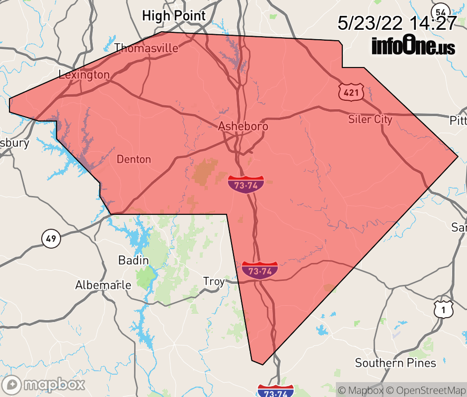 |
|||||||||
 Why aren't you using the InfoOne app? Why aren't you using the InfoOne app?
Stay abreast of information affecting your community! InfoOne tracks real-time information such as:
InfoOne currently supports over 100 communities in NC, VA and WV, and our coverage area is steadily growing. It's free! Install the InfoOne app today and see what you've been missing. |
|||||||||