
|
Weather Alert |
| Moore County, NC | |||||||||
|
|
||||||||
|
Canceled 10/11/26 10:29 AM Tornado Warning issued October 11 at 10:15AM EDT until October 11 at 10:30AM EDT by NWS Raleigh NC At 1014 AM EDT, a severe thunderstorm capable of producing a tornado was located near Biscoe, or 9 miles east of Troy, moving northeast at 30 mph. HAZARD...Tornado. SOURCE...Radar indicated rotation. IMPACT...Flying debris will be dangerous to those caught without shelter. Mobile homes will be damaged or destroyed. Damage to roofs, windows, and vehicles will occur. Tree damage is likely. This tornadic thunderstorm will remain over mainly rural areas of northwestern Moore and east central Montgomery Counties, including the following locations... Candor, Eagle Springs, Robbins, and Seven Lakes. This includes Interstate 73 between Mile Markers 41 and 49. 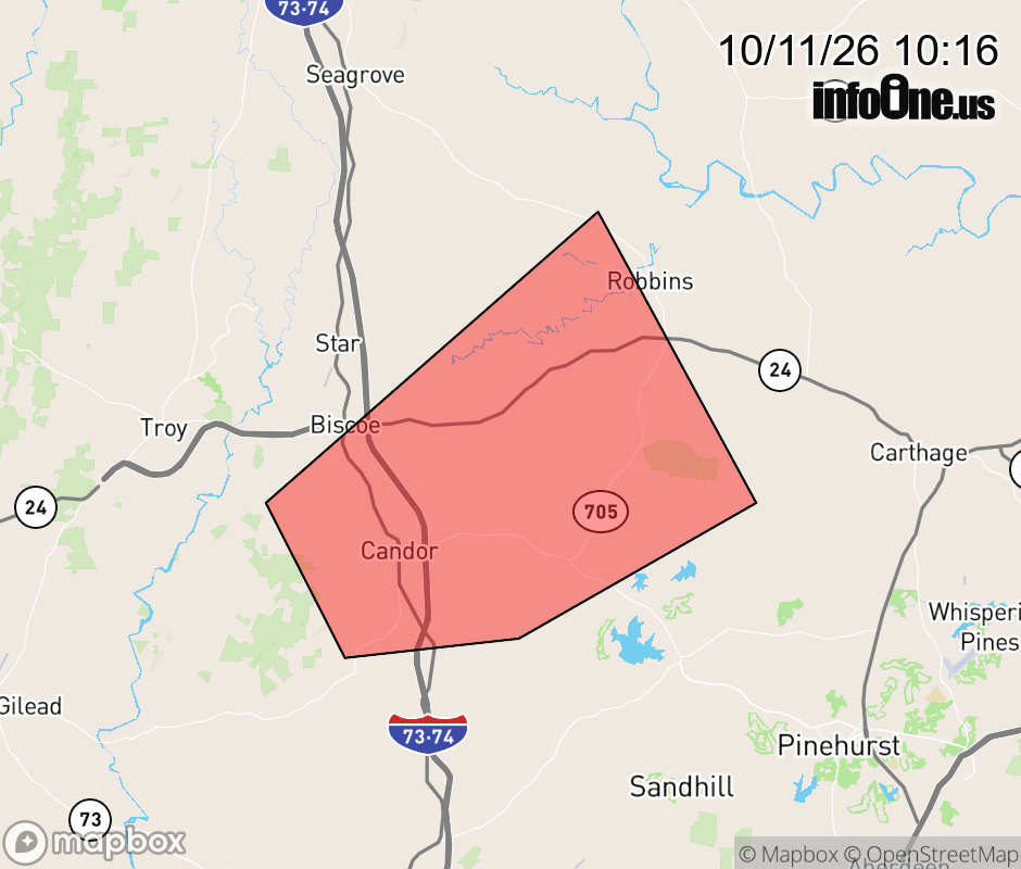 |
|||||||||
 Why aren't you using the InfoOne app? Why aren't you using the InfoOne app?
Stay abreast of information affecting your community! InfoOne tracks real-time information such as:
InfoOne currently supports over 100 communities in NC, VA and WV, and our coverage area is steadily growing. It's free! Install the InfoOne app today and see what you've been missing. |
|||||||||