|
|
Weather Alert |
| Taylor County, WV | |||||||||
|
|
||||||||
|
Canceled 10/21/25 8:09 PM Severe Thunderstorm Warning issued October 21 at 7:50PM EDT until October 21 at 8:30PM EDT by NWS Charleston WV SVRRLX The National Weather Service in Charleston West Virginia has issued a * Severe Thunderstorm Warning for... North central Randolph County in northeastern West Virginia... Southern Taylor County in northern West Virginia... Northeastern Upshur County in northeastern West Virginia... Barbour County in northeastern West Virginia... Southeastern Harrison County in northern West Virginia... * Until 830 PM EDT. * At 749 PM EDT, a severe thunderstorm was located 8 miles north of Buckhannon, moving east at 40 mph. HAZARD...60 mph wind gusts and half dollar size hail. SOURCE...Trained weather spotters. IMPACT...Hail damage to vehicles is expected. Expect wind damage to roofs, siding, and trees. * Locations impacted include... Grafton, Philippi, Audra State Park, Flemington, Montrose, Moatsville, Volga, Rosemont, Knottsville, Century, Nestorville, Tygart Lake State Park, Thornton, Hodgesville, and Galloway. This includes Interstate 79 between mile markers 112 and 114. 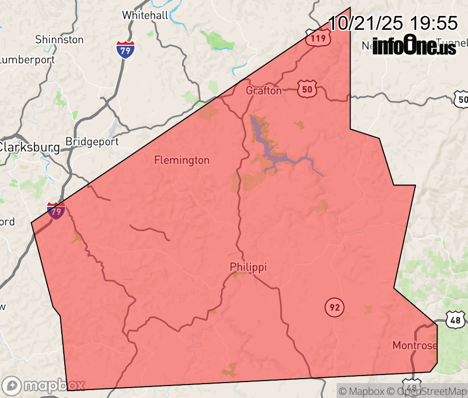 |
|||||||||
 Why aren't you using the InfoOne app? Why aren't you using the InfoOne app?
Stay abreast of information affecting your community! InfoOne tracks real-time information such as:
InfoOne currently supports over 100 communities in NC, VA and WV, and our coverage area is steadily growing. It's free! Install the InfoOne app today and see what you've been missing. |
|||||||||