
|
Weather Alert |
| Columbiana County, OH | |||||||||
|
|
||||||||
|
Canceled 9/3/26 5:46 PM Severe Thunderstorm Warning issued September 3 at 5:31PM EDT until September 3 at 6:00PM EDT by NWS Pittsburgh PA At 531 PM EDT, severe thunderstorms were located along a line from 6 miles northeast of Zelienople to near Midland, or along a line from 10 miles west of Butler to 7 miles southeast of East Liverpool, moving southeast at 20 mph. THESE ARE DESTRUCTIVE STORMS FOR BEAVER, MONACA, CONWAY, ALIQUIPPA. HAZARD...80 mph wind gusts and quarter size hail. SOURCE...Radar indicated. IMPACT...Flying debris will be dangerous to those caught without shelter. Mobile homes will be heavily damaged. Expect considerable damage to roofs, windows, and vehicles. Extensive tree damage and power outages are likely. Locations impacted include... Ross Township, McCandless Township, Cranberry, Moon Township, Butler, Franklin Park, East Liverpool, Aliquippa, Beaver Falls, Monaca, Hampton Township, Robinson Township, Economy, Bellevue, Kennedy Township, Ambridge, Wexford, Homeacre-Lyndora, West View and Stowe Township. 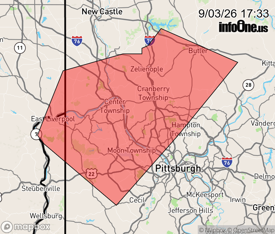 |
|||||||||
 Why aren't you using the InfoOne app? Why aren't you using the InfoOne app?
Stay abreast of information affecting your community! InfoOne tracks real-time information such as:
InfoOne currently supports over 100 communities in NC, VA and WV, and our coverage area is steadily growing. It's free! Install the InfoOne app today and see what you've been missing. |
|||||||||