|
|
Weather Alert |
| Lee County, VA | |||||||||
|
|
||||||||
|
Canceled 1/23/26 9:55 AM Winter Storm Watch issued January 23 at 12:33AM EST until January 25 at 7:00PM EST by NWS Morristown TN * WHAT... Heavy mixed precipitation possible. Total snow accumulations up to 3 inches and ice accumulations of one quarter of an inch to one half of an inch possible. The highest snowfall totals will be in the higher elevations southwest Virginia and near the Kentucky and Tennessee border. The greatest ice accumulations will be along the Cumberland Plateau, northeast Tennessee, the mountains, and just north of Interstate 40/81. Snow accumulations will be more limited further south. * WHERE... Portions of southwest North Carolina, east Tennessee, and southwest Virginia. * WHEN... From Saturday morning through Sunday evening. * IMPACTS... Roads, and especially bridges and overpasses, will likely become slick and hazardous. Power outages and tree damage are likely due to the ice. Travel could be nearly impossible. * ADDITIONAL DETAILS... This is a complicated forecast and details regarding the location of heaviest snowfall and freezing rain totals remain uncertain. Significant changes could occur over the next 24 hours so please continue to monitor future forecasts. 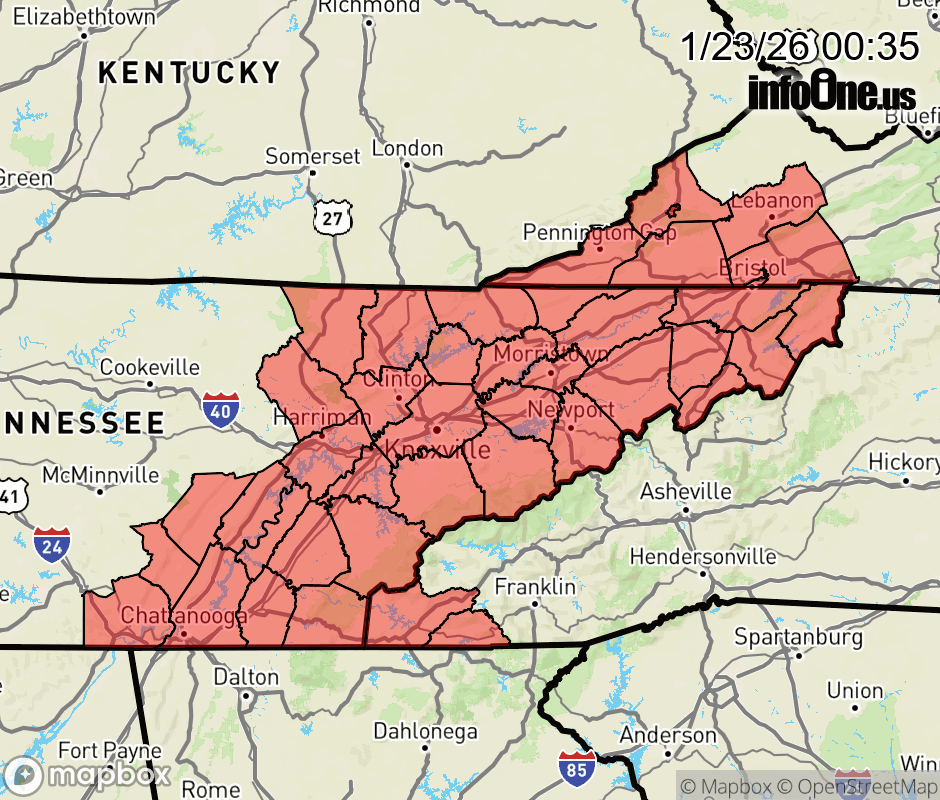 |
|||||||||
 Why aren't you using the InfoOne app? Why aren't you using the InfoOne app?
Stay abreast of information affecting your community! InfoOne tracks real-time information such as:
InfoOne currently supports over 100 communities in NC, VA and WV, and our coverage area is steadily growing. It's free! Install the InfoOne app today and see what you've been missing. |
|||||||||