|
|
Weather Alert |
| Belmont County, OH | |||||||||
|
|
||||||||
|
Canceled 3/26/26 10:02 PM Severe Thunderstorm Warning issued March 26 at 9:46PM EDT until March 26 at 10:30PM EDT by NWS Pittsburgh PA At 946 PM EDT, a severe thunderstorm was located near West Lafayette, or 5 miles southeast of Coshocton, moving southeast at 50 mph. HAZARD...Ping pong ball size hail and 60 mph wind gusts. SOURCE...Public reported 1 1/2 inch hail in Warsaw. IMPACT...People and animals outdoors will be injured. Expect hail damage to roofs, siding, windows, and vehicles. Expect wind damage to roofs, siding, and trees. Locations impacted include... Coshocton, Cambridge, Newcomerstown, Byesville, West Lafayette, Antrim, Senecaville, Pleasant City, Conesville, Lore City, Old Washington, Plainfield, Salesville, Otsego, Boden, Birmingham, Seneca Lake Park, Kimbolton and Salt Fork State Park. 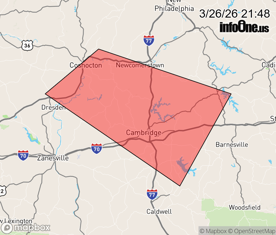 |
|||||||||
 Why aren't you using the InfoOne app? Why aren't you using the InfoOne app?
Stay abreast of information affecting your community! InfoOne tracks real-time information such as:
InfoOne currently supports over 100 communities in NC, VA and WV, and our coverage area is steadily growing. It's free! Install the InfoOne app today and see what you've been missing. |
|||||||||