|
|
Weather Alert |
| Tyler County, WV | |||||||||
|
|
||||||||
|
Canceled 3/4/26 8:30 AM Flood Warning issued March 4 at 6:03AM EST until March 4 at 8:30AM EST by NWS Charleston WV * WHAT... Flooding caused by excessive rainfall continues. * WHERE... Portions of central and northern West Virginia, including the following counties, in central West Virginia, Braxton, Calhoun, Gilmer and Roane. In northern West Virginia, Doddridge, Harrison, Lewis, Pleasants, Ritchie, Tyler, Wirt and Wood. * WHEN... Until 830 AM EST. * IMPACTS... Flooding of rivers, creeks, streams, and other low-lying and flood-prone locations is imminent or occurring. * ADDITIONAL DETAILS... - At 555 AM EST, Earlier heavy rain has lessened this morning, but additional rounds of moderate to heavy rain are likely later this morning. Between 1 and 2 inches of rain have fallen and flooding is already occurring within the warned area. The upper reaches of Meathouse Fork is now in action stage and slowly rising. In addition, the South Fork Hughes River below Macfarlan is in action stage and slowly rising. At 16 feet, a low spot on Oxbow Road below the gage floods. - Additional rainfall amounts up to 0.5 inches are possible in the warned area this morning. Additional rain is likely late morning into the afternoon. - Some locations that will experience flooding include... Clarksburg, Weston, Spencer, Harrisville, Glenville, Grantsville, Stonewood, Nutter Fort, Salem, Pennsboro, West Union, Cedar Creek State Park, North Bend State Park, Jackson Mill, Arnoldsburg, Stonewall Jackson, West Milford, Burnsville, Lost Creek and Jane Lew. - http://www.weather.gov/safety/flood 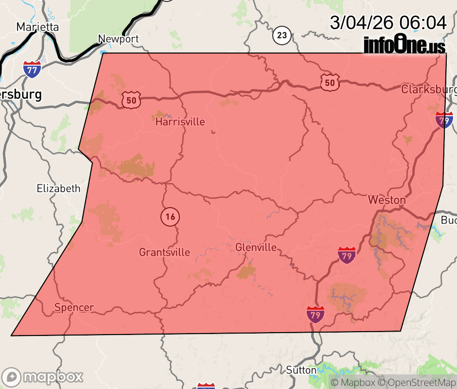 |
|||||||||
 Why aren't you using the InfoOne app? Why aren't you using the InfoOne app?
Stay abreast of information affecting your community! InfoOne tracks real-time information such as:
InfoOne currently supports over 100 communities in NC, VA and WV, and our coverage area is steadily growing. It's free! Install the InfoOne app today and see what you've been missing. |
|||||||||