|
|
Weather Alert |
| Clay County, WV | |||||||||
|
|
||||||||
|
Canceled 5/30/25 2:21 PM Severe Thunderstorm Warning issued May 30 at 2:03PM EDT until May 30 at 3:00PM EDT by NWS Charleston WV SVRRLX The National Weather Service in Charleston West Virginia has issued a * Severe Thunderstorm Warning for... Nicholas County in southeastern West Virginia... Southeastern Kanawha County in central West Virginia... North central Raleigh County in southeastern West Virginia... South central Clay County in north central West Virginia... Fayette County in southeastern West Virginia... * Until 300 PM EDT. * At 202 PM EDT, severe thunderstorms were located along a line extending from near Pratt to near Powellton to 8 miles south of Burnwell, moving east at 45 mph. HAZARD...60 mph wind gusts. SOURCE...Radar indicated. IMPACT...Expect damage to roofs, siding, and trees. * Locations impacted include... Summersville, Fayetteville, Babcock State Park, Oak Hill, Montgomery, Mount Hope, Ansted, Smithers, Gauley Bridge, Pratt, Powellton, Hawks Nest State Park, Craigsville, Burnwell, Handley, Pax, Thurmond, Muddlety, Swiss, and Artie. This includes the following highways... West Virginia Turnpike between mile markers 55 and 74. Route 19 between mile markers 7 and 50. 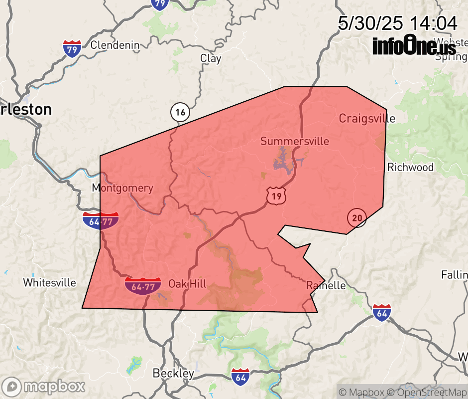 |
|||||||||
 Why aren't you using the InfoOne app? Why aren't you using the InfoOne app?
Stay abreast of information affecting your community! InfoOne tracks real-time information such as:
InfoOne currently supports over 100 communities in NC, VA and WV, and our coverage area is steadily growing. It's free! Install the InfoOne app today and see what you've been missing. |
|||||||||