|
|
Weather Alert |
| Franklin County, OH | |||||||||
|
|
||||||||
|
Canceled 6/14/26 4:18 PM Severe Thunderstorm Warning issued June 14 at 4:03PM EDT until June 14 at 4:45PM EDT by NWS Wilmington OH SVRILN The National Weather Service in Wilmington has issued a * Severe Thunderstorm Warning for... Franklin County in central Ohio... Northwestern Fairfield County in central Ohio... Southwestern Licking County in central Ohio... * Until 445 PM EDT. * At 402 PM EDT, severe thunderstorms were located along a line extending from Westerville to Lake Darby, moving east at 45 mph. HAZARD...60 mph wind gusts. SOURCE...Radar indicated. IMPACT...Expect damage to trees and power lines. * Locations impacted include... Columbus, Newark, Westerville, Reynoldsburg, Grove City, Upper Arlington, Gahanna, Pickerington, Bexley, Heath, Granville, Pataskala, Canal Winchester, Groveport, Baltimore, Buckeye Lake, Hebron, Minerva Park, Millersport, and Fairfield Beach. This includes the following Interstates... I-70 in Ohio between mile markers 94 and 132. I-71 in Ohio between mile markers 91 and 117. 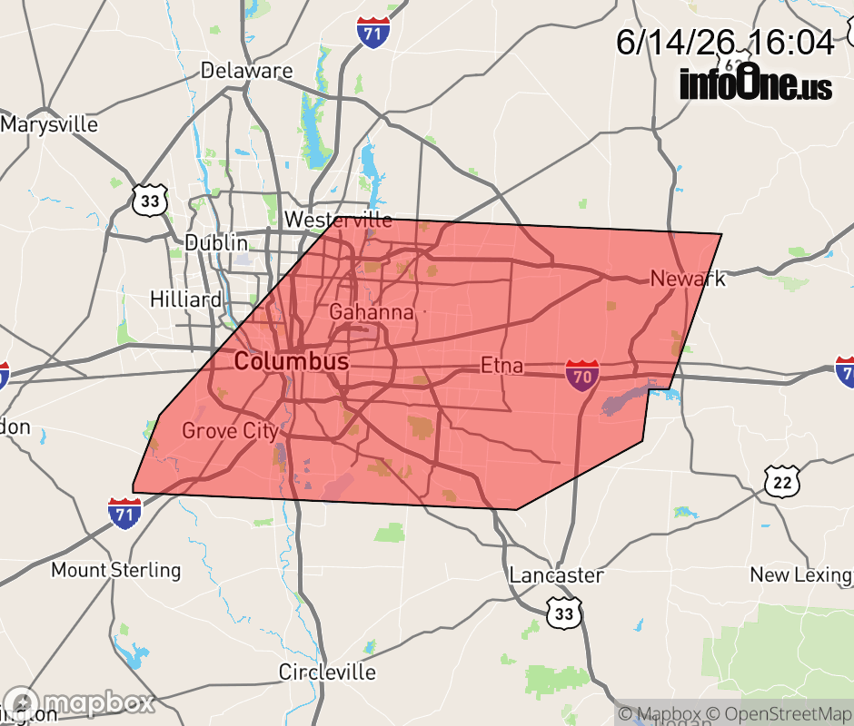 |
|||||||||
 Why aren't you using the InfoOne app? Why aren't you using the InfoOne app?
Stay abreast of information affecting your community! InfoOne tracks real-time information such as:
InfoOne currently supports over 100 communities in NC, VA and WV, and our coverage area is steadily growing. It's free! Install the InfoOne app today and see what you've been missing. |
|||||||||