|
|
Weather Alert |
| Franklin County, OH | |||||||||
|
|
||||||||
|
Canceled 5/20/26 7:30 AM Severe Thunderstorm Warning issued May 20 at 7:05AM EDT until May 20 at 7:30AM EDT by NWS Wilmington OH SVRILN The National Weather Service in Wilmington has issued a * Severe Thunderstorm Warning for... Eastern Franklin County in central Ohio... * Until 730 AM EDT. * At 705 AM EDT, a severe thunderstorm was located over Columbus, moving northeast at 35 mph. HAZARD...60 mph wind gusts. SOURCE...Radar indicated. IMPACT...Expect damage to trees and power lines. * Locations impacted include... Columbus, Westerville, Reynoldsburg, Upper Arlington, Gahanna, Worthington, Bexley, Pataskala, Minerva Park, Ohio State University, Easton, Whitehall, New Albany, Grandview Heights, Obetz, Valleyview, Marble Cliff, Port Columbus Airport, Huber Ridge, and Clintonville. This includes the following Interstates... I-70 in Ohio between mile markers 94 and 107. I-71 in Ohio between mile markers 103 and 119. 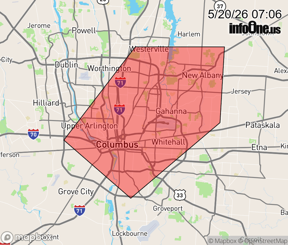 |
|||||||||
 Why aren't you using the InfoOne app? Why aren't you using the InfoOne app?
Stay abreast of information affecting your community! InfoOne tracks real-time information such as:
InfoOne currently supports over 100 communities in NC, VA and WV, and our coverage area is steadily growing. It's free! Install the InfoOne app today and see what you've been missing. |
|||||||||