|
|
Weather Alert |
| Franklin County, OH | |||||||||
|
|
||||||||
|
Canceled 6/25/25 1:58 PM Severe Thunderstorm Warning issued June 25 at 1:44PM EDT until June 25 at 2:30PM EDT by NWS Wilmington OH SVRILN The National Weather Service in Wilmington has issued a * Severe Thunderstorm Warning for... Southeastern Franklin County in central Ohio... Northern Fairfield County in central Ohio... Southern Licking County in central Ohio... * Until 230 PM EDT. * At 143 PM EDT, a severe thunderstorm was located near Beechwood Trails, moving east at 20 mph. HAZARD...60 mph wind gusts. SOURCE...Radar indicated. IMPACT...Expect damage to trees and power lines. * Locations impacted include... Columbus, Newark, Reynoldsburg, Gahanna, Pickerington, Bexley, Heath, Granville, Pataskala, Canal Winchester, Groveport, Baltimore, Buckeye Lake, Hebron, Millersport, Pleasantville, Hanover, Harbor Hills, Granville South, and Marne. This includes the following Interstates... I-70 in Ohio between mile markers 101 and 142, and near mile marker 144. I-71 in Ohio between mile markers 108 and 109. 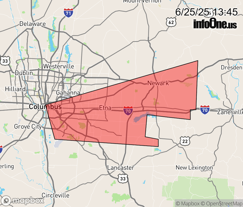 |
|||||||||
 Why aren't you using the InfoOne app? Why aren't you using the InfoOne app?
Stay abreast of information affecting your community! InfoOne tracks real-time information such as:
InfoOne currently supports over 100 communities in NC, VA and WV, and our coverage area is steadily growing. It's free! Install the InfoOne app today and see what you've been missing. |
|||||||||