|
|
Weather Alert |
| Buncombe County, NC | |||||||||
|
|
||||||||
|
Canceled 1/24/26 2:38 PM Ice Storm Warning issued January 24 at 2:35AM EST until January 26 at 1:00PM EST by NWS Greenville-Spartanburg SC * WHAT... Significant icing expected. Total snow accumulations up to one inch and ice accumulations between one tenth and one quarter inch in the valleys, and between one half and one inch in the higher elevations. Winds gusting as high as 45 mph. * WHERE... A portion of the mountains of western North Carolina near the Tennessee border, including northern Jackson County. * WHEN... From 1 PM this afternoon to 1 PM EST Monday. * IMPACTS... Widespread power outages are likely due to the weight of the ice and snow on tree limbs and power lines. Trees and large limbs could fall on structures, posing threat to life and property. The outages could last for days in some areas. Ice and snow covered roadways will become treacherous and impassable. The hazardous conditions could impact the Monday morning commute. Gusty winds could bring down tree branches. * ADDITIONAL DETAILS... Ice, snow and sleet accumulations will increase rapidly between 7 PM Saturday evening and midnight Sunday morning. A transition to rain is expected in the valleys of the Tennessee border counties as early as Sunday morning. The rain may change to light snow Sunday night and early Monday morning, while very cold temperatures could result in roads refreezing Sunday night. 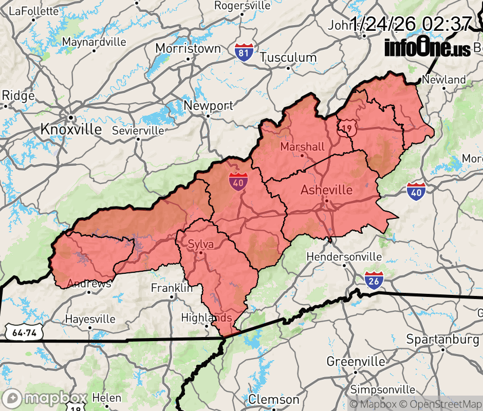 |
|||||||||
 Why aren't you using the InfoOne app? Why aren't you using the InfoOne app?
Stay abreast of information affecting your community! InfoOne tracks real-time information such as:
InfoOne currently supports over 100 communities in NC, VA and WV, and our coverage area is steadily growing. It's free! Install the InfoOne app today and see what you've been missing. |
|||||||||