|
|
Weather Alert |
| Kanawha County, WV | |||||||||
|
|
||||||||
|
Canceled 2/20/26 4:00 AM Severe Thunderstorm Warning issued February 20 at 3:14AM EST until February 20 at 4:00AM EST by NWS Charleston WV SVRRLX The National Weather Service in Charleston West Virginia has issued a * Severe Thunderstorm Warning for... Southeastern Kanawha County in central West Virginia... Northwestern Raleigh County in southeastern West Virginia... Northwestern Fayette County in southeastern West Virginia... East central Boone County in central West Virginia... * Until 400 AM EST. * At 314 AM EST, a severe thunderstorm was located near Van, or 10 miles southeast of Madison, moving east at 50 mph. HAZARD...60 mph wind gusts and nickel size hail. SOURCE...Radar indicated. IMPACT...Expect damage to roofs, siding, and trees. * Locations impacted include... Oak Hill, Montgomery, Smithers, Van, Burnwell, Powellton, Whitesville, Handley, Sylvester, Leewood, Dawes, Prenter, Eskdale, and Dorothy. This includes the following highways... West Virginia Turnpike between mile markers 57 and 79. Route 19 near mile marker 10. 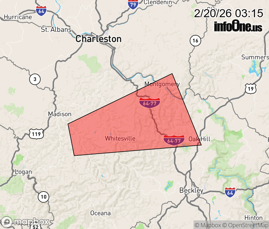 |
|||||||||
 Why aren't you using the InfoOne app? Why aren't you using the InfoOne app?
Stay abreast of information affecting your community! InfoOne tracks real-time information such as:
InfoOne currently supports over 100 communities in NC, VA and WV, and our coverage area is steadily growing. It's free! Install the InfoOne app today and see what you've been missing. |
|||||||||