|
|
Weather Alert |
| Berkeley County, WV | |||||||||
|
|
||||||||
|
Canceled 11/5/25 9:43 PM Severe Thunderstorm Warning issued November 5 at 9:15PM EST until November 5 at 9:45PM EST by NWS Baltimore MD/Washington DC At 915 PM EST, severe thunderstorms were located along a line extending from near Thurmont to near Wolfsville to Boonsboro to Inwood, moving east at 45 mph. HAZARD...60 mph wind gusts. SOURCE...Radar indicated and observed wind at Hagerstown Regional Airport and near Thurmont. IMPACT...Damaging winds will cause some trees and large branches to fall. This could injure those outdoors, as well as damage homes and vehicles. Roadways may become blocked by downed trees. Localized power outages are possible. Unsecured light objects may become projectiles. Locations impacted include... Frederick, Hagerstown, Martinsburg, Thurmont, Charles Town, Emmitsburg, Shepherdstown, Municipal Stadium, Harry Grove Stadium, Ballenger Creek, Purcellville, Robinwood, Brunswick, Walkersville, Fountainhead-Orchard Hills, Ranson, Boonsboro, Smithsburg, Inwood, and Braddock Heights. 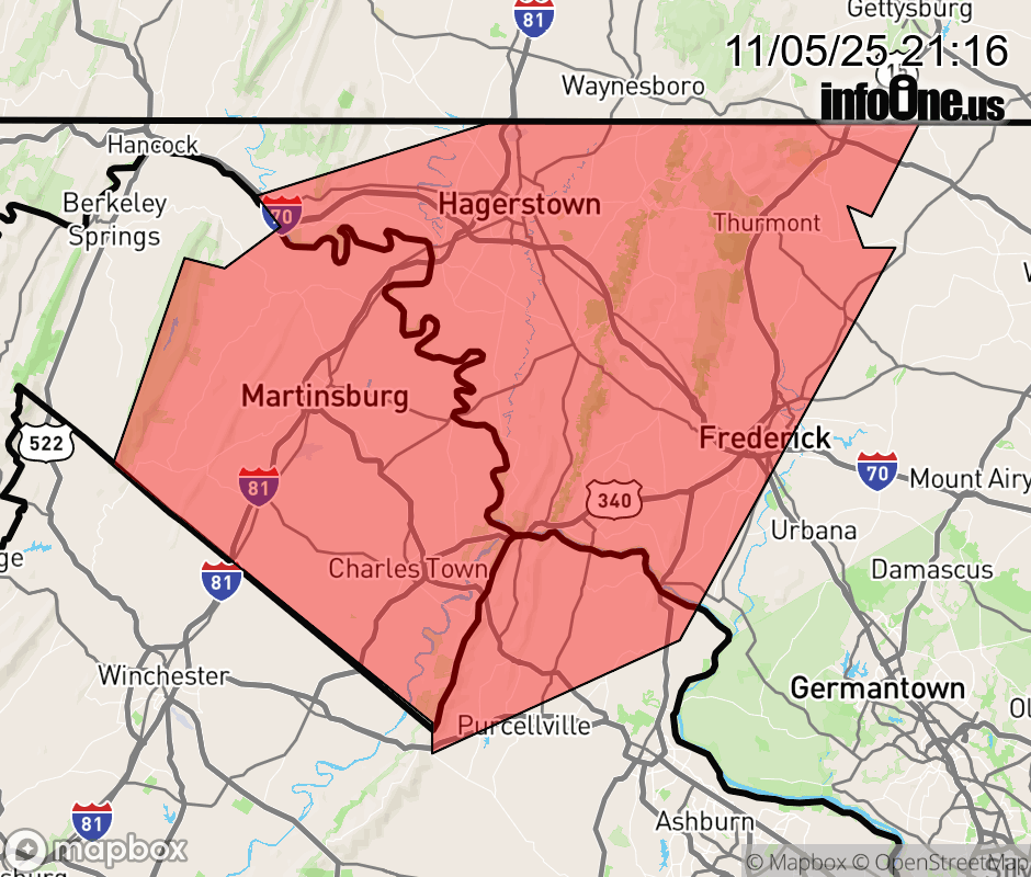 |
|||||||||
 Why aren't you using the InfoOne app? Why aren't you using the InfoOne app?
Stay abreast of information affecting your community! InfoOne tracks real-time information such as:
InfoOne currently supports over 100 communities in NC, VA and WV, and our coverage area is steadily growing. It's free! Install the InfoOne app today and see what you've been missing. |
|||||||||