|
|
Weather Alert |
| Summit County, OH | |||||||||
|
|
||||||||
|
Canceled 12/9/25 10:00 PM Special Weather Statement issued December 9 at 3:57PM EST by NWS Cleveland OH A burst of wet snow is expected late tonight and early Wednesday morning, with precipitation becoming lighter and changing to mainly rain by later Wednesday morning as temperatures warm. Snow rates are expected to be heaviest during the morning commute. Wet snow accumulations of 2 to 3 inches are expected across the higher elevations of eastern Cuyahoga County, northern Summit County, southern Lake County, Geauga County, northern Portage County, inland Ashtabula County and northern Trumbull County. Lighter accumulations of under 2 inches of slushy snow are expected across the lower elevations and closer to Lake Erie, including in the cities of Cleveland, Akron, Youngstown, and Erie. A period of slushy and slick road conditions may impact the Wednesday morning commute. The greatest impact will be in the higher elevations. Plan on giving yourself extra time to reach your destination if traveling early Wednesday. 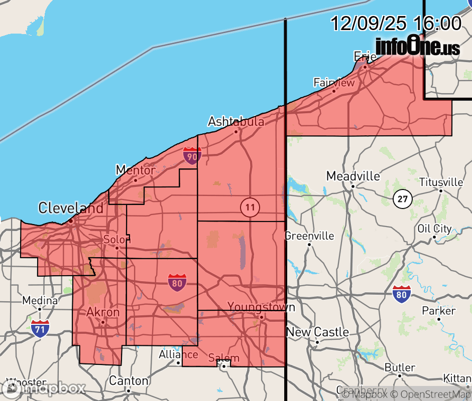 |
|||||||||
 Why aren't you using the InfoOne app? Why aren't you using the InfoOne app?
Stay abreast of information affecting your community! InfoOne tracks real-time information such as:
InfoOne currently supports over 100 communities in NC, VA and WV, and our coverage area is steadily growing. It's free! Install the InfoOne app today and see what you've been missing. |
|||||||||