|
|
Weather Alert |
| Durham County, NC | |||||||||
|
|
||||||||
|
Canceled 5/14/25 3:19 PM Flood Advisory issued May 14 at 1:48PM EDT until May 14 at 5:00PM EDT by NWS Raleigh NC * WHAT... Urban and small stream flooding caused by excessive rainfall is expected. * WHERE... A portion of central North Carolina, including the following counties, Southeast Durham and western Wake. * WHEN... Until 500 PM EDT. * IMPACTS... Minor flooding in low-lying and poor drainage areas. * ADDITIONAL DETAILS... - At 148 PM EDT, Doppler radar indicated heavy rain due to thunderstorms. This will cause urban and small stream flooding. Overflowing poor drainage areas will cause minor flooding in the advisory area. Between 0.5 and 1 inch of rain has fallen. - Additional rainfall amounts of 1 to 2 inches are expected over the area. This additional rain will result in minor flooding. - Some locations that will experience flooding include... Raleigh, Durham, Cary, Wake Forest, Garner, Fuquay-Varina, RDU International, Apex, Holly Springs, Morrisville, William B Umstead State Park, Research Triangle, Lake Wheeler, Carpenter, Falls Lake Boat Ramp, Lake Benson, Rollingview Marina, Falls Lake, Falls Lake State Rec Area and New Hill. - http://www.weather.gov/safety/flood 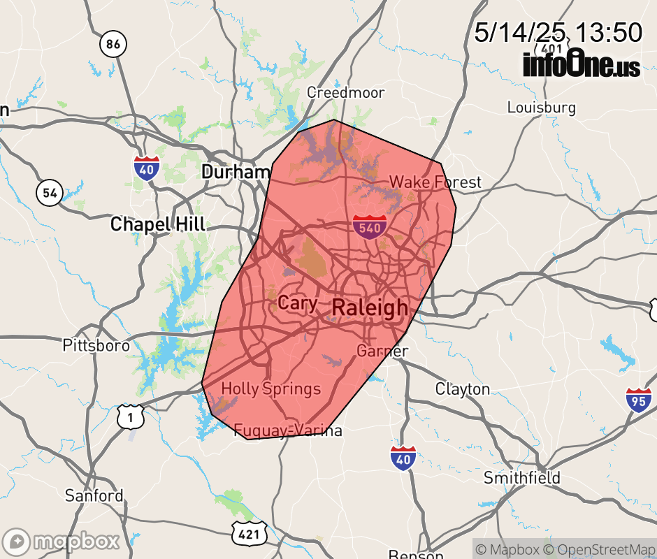 |
|||||||||
 Why aren't you using the InfoOne app? Why aren't you using the InfoOne app?
Stay abreast of information affecting your community! InfoOne tracks real-time information such as:
InfoOne currently supports over 100 communities in NC, VA and WV, and our coverage area is steadily growing. It's free! Install the InfoOne app today and see what you've been missing. |
|||||||||