|
|
Weather Alert |
| Franklin County, OH | |||||||||
|
|
||||||||
|
Canceled 5/21/22 3:00 PM Special Weather Statement issued May 21 at 2:29PM EDT by NWS Wilmington OH At 229 PM EDT, a rapidly developing thunderstorm was located near Mount Sterling, moving northeast at 25 mph. HAZARD...Wind gusts up to 45 mph, half inch hail, and very heavy rain. SOURCE...Radar indicated. IMPACT...Gusty winds could knock down tree limbs and blow around unsecured objects. Hail may cause minor damage to outdoor objects. Visibility will be poor and hydroplaning is possible. Locations impacted include... Columbus, Grove City, Upper Arlington, Groveport, Mount Sterling, Grandview Heights, Obetz, Commercial Point, Urbancrest, Valleyview, Marble Cliff, Harrisburg, Orient, Lockbourne, Chenoweth, Derby, Georgesville, Darbydale, Big Plain and Wrightsville. This includes the following Interstates... I-70 in Ohio between mile markers 92 and 100. I-71 in Ohio between mile markers 76 and 107. 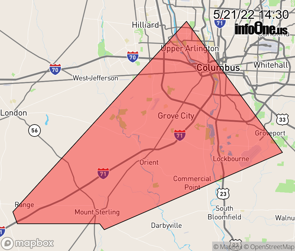 |
|||||||||
 Why aren't you using the InfoOne app? Why aren't you using the InfoOne app?
Stay abreast of information affecting your community! InfoOne tracks real-time information such as:
InfoOne currently supports over 100 communities in NC, VA and WV, and our coverage area is steadily growing. It's free! Install the InfoOne app today and see what you've been missing. |
|||||||||