|
|
Weather Alert |
| Washington County, OH | |||||||||
|
|
||||||||
|
Canceled 2/19/26 11:51 PM Severe Thunderstorm Warning issued February 19 at 11:33PM EST until February 20 at 12:00AM EST by NWS Charleston WV SVRRLX The National Weather Service in Charleston West Virginia has issued a * Severe Thunderstorm Warning for... Central Washington County in southeastern Ohio... Southwestern Pleasants County in northwestern West Virginia... West central Ritchie County in northwestern West Virginia... Northern Wirt County in northwestern West Virginia... Central Wood County in northwestern West Virginia... * Until midnight EST. * At 1133 PM EST, a severe thunderstorm was located near Mineralwells, or 8 miles south of Parkersburg, moving northeast at 50 mph. HAZARD...Quarter size hail. SOURCE...Radar indicated. IMPACT...Damage to vehicles is expected. * Locations impacted include... Parkersburg, Elizabeth, Mineralwells, North Bend State Park, Cairo, Willow Island, Nutter Farm, Walker, Petroleum, Palestine, Schultz, Waverly, Freeport, Davisville, Greencastle, and Morristown. This includes the following highways... Interstate 77 in West Virginia between mile markers 163 and 177. Route 50 in West Virginia between mile markers 8 and 32. 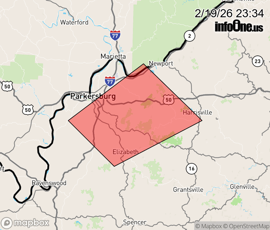 |
|||||||||
 Why aren't you using the InfoOne app? Why aren't you using the InfoOne app?
Stay abreast of information affecting your community! InfoOne tracks real-time information such as:
InfoOne currently supports over 100 communities in NC, VA and WV, and our coverage area is steadily growing. It's free! Install the InfoOne app today and see what you've been missing. |
|||||||||