|
|
Weather Alert |
| Roane County, WV | |||||||||
|
|
||||||||
|
Canceled 5/20/26 4:59 PM Severe Thunderstorm Warning issued May 20 at 4:39PM EDT until May 20 at 5:30PM EDT by NWS Charleston WV SVRRLX The National Weather Service in Charleston West Virginia has issued a * Severe Thunderstorm Warning for... Northeastern Kanawha County in central West Virginia... Southwestern Roane County in central West Virginia... West central Clay County in north central West Virginia... * Until 530 PM EDT. * At 438 PM EDT, a severe thunderstorm was located near Sissonville, or 7 miles north of Charleston, moving east at 15 mph. HAZARD...Golf ball size hail and 60 mph wind gusts. SOURCE...Radar indicated. IMPACT...People and animals outdoors will be injured. Expect hail damage to roofs, siding, windows, and vehicles. Expect wind damage to roofs, siding, and trees. * Locations impacted include... Sissonville, Clendenin, Pinch, Elkview, Amma, Glen, and Left Hand. This includes the following highways... Interstate 79 between mile markers 3 and 27. Interstate 77 in West Virginia between mile markers 114 and 116. 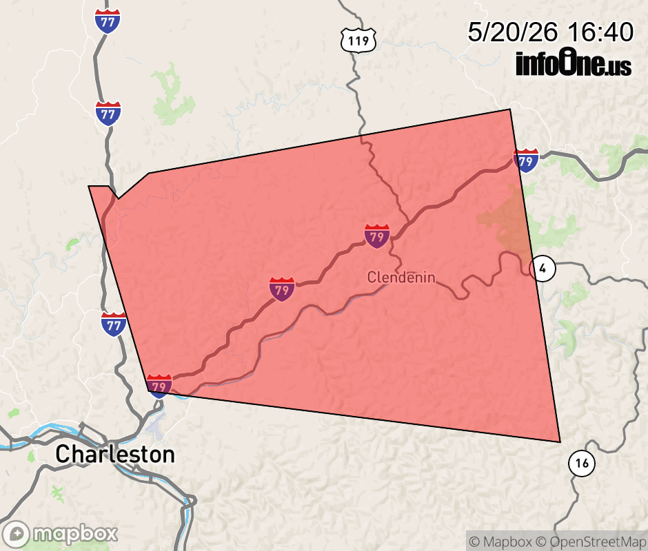 |
|||||||||
 Why aren't you using the InfoOne app? Why aren't you using the InfoOne app?
Stay abreast of information affecting your community! InfoOne tracks real-time information such as:
InfoOne currently supports over 100 communities in NC, VA and WV, and our coverage area is steadily growing. It's free! Install the InfoOne app today and see what you've been missing. |
|||||||||