|
|
Weather Alert |
| Franklin County, OH | |||||||||
|
|
||||||||
|
Canceled 7/12/25 6:15 PM Special Weather Statement issued July 12 at 5:37PM EDT by NWS Wilmington OH At 537 PM EDT, a strong thunderstorm was located over Dublin, moving northeast at 25 mph. HAZARD...Wind gusts up to 40 mph. SOURCE...Radar indicated. IMPACT...Gusty winds could knock down tree limbs and blow around unsecured objects. Locations impacted include... Columbus, Dublin, Westerville, Delaware, Upper Arlington, Gahanna, Hilliard, Marysville, Worthington, Powell, Sunbury, Minerva Park, New California, Polaris, Easton, New Albany, Radnor, Shawnee Hills, Galena, and Ostrander. This includes I-71 in Ohio between mile markers 112 and 138. If outdoors, consider seeking shelter inside a sturdy building. To report hazardous weather conditions, go to our website at weather.gov/iln and submit your report via social media, when you can do so safely. 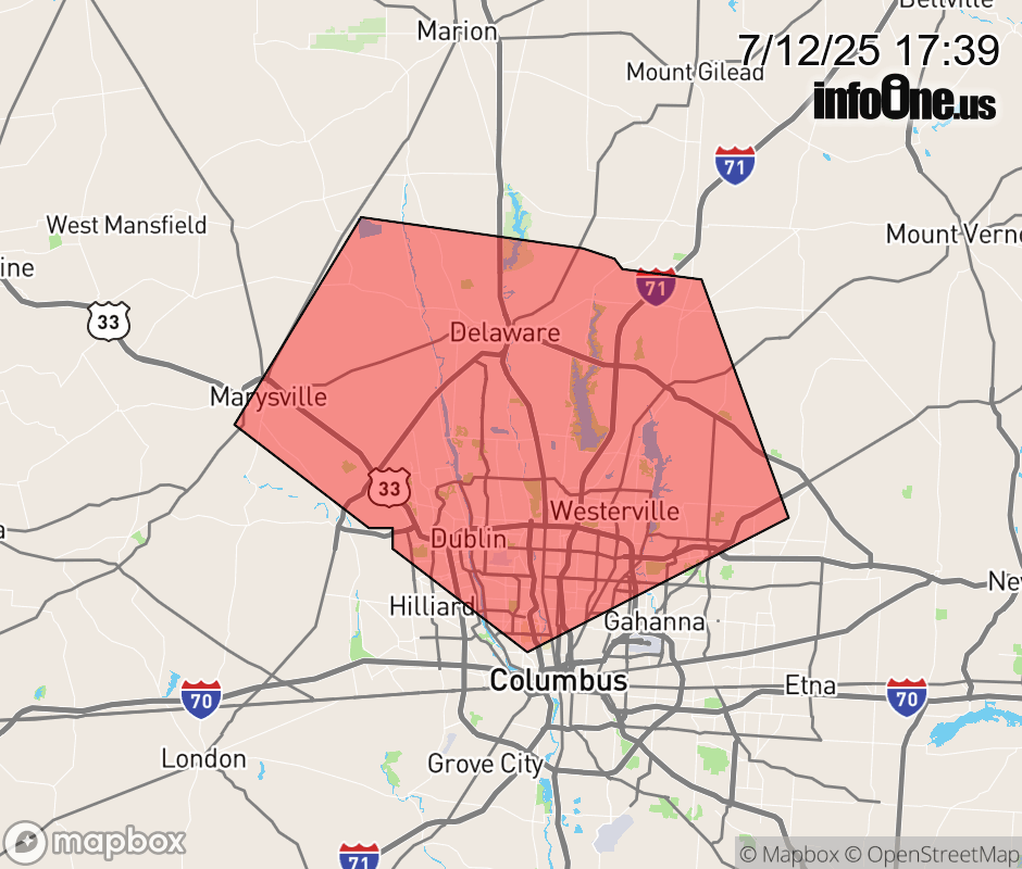 |
|||||||||
 Why aren't you using the InfoOne app? Why aren't you using the InfoOne app?
Stay abreast of information affecting your community! InfoOne tracks real-time information such as:
InfoOne currently supports over 100 communities in NC, VA and WV, and our coverage area is steadily growing. It's free! Install the InfoOne app today and see what you've been missing. |
|||||||||