|
|
Weather Alert |
| Caswell County, NC | |||||||||
|
|
||||||||
|
Canceled 7/25/24 12:15 AM Special Weather Statement issued July 24 at 11:49PM EDT by NWS Blacksburg VA At 1147 PM EDT, Doppler radar was tracking strong thunderstorms along a line extending from Kernersville to near Prospect Hill. Movement was northeast at 35 mph. HAZARD...Locally heavy rain. SOURCE...Radar indicated. IMPACT...Ponding of water on roadways, standing water in low lying areas, and minor flooding of creeks, streams, and areas of poor drainage. Locations impacted include... Reidsville... Jericho... Prospect Hill... Camp Springs... Hightowers... Baynes... and Monroeton. 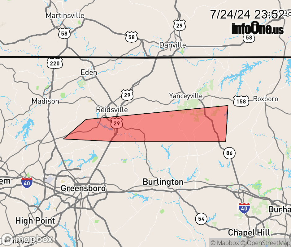 |
|||||||||
 Why aren't you using the InfoOne app? Why aren't you using the InfoOne app?
Stay abreast of information affecting your community! InfoOne tracks real-time information such as:
InfoOne currently supports over 100 communities in NC, VA and WV, and our coverage area is steadily growing. It's free! Install the InfoOne app today and see what you've been missing. |
|||||||||