|
|
Weather Alert |
| Franklin County, OH | |||||||||
|
|
||||||||
|
Canceled 7/12/25 3:46 PM Severe Thunderstorm Warning issued July 12 at 3:23PM EDT until July 12 at 4:00PM EDT by NWS Wilmington OH At 323 PM EDT, a severe thunderstorm was located over Columbus, moving northeast at 25 mph. HAZARD...60 mph wind gusts and penny size hail. SOURCE...Radar indicated. IMPACT...Expect damage to trees and power lines. Locations impacted include... Columbus, Westerville, Reynoldsburg, Grove City, Gahanna, Bexley, Pataskala, Ohio State University, Easton, Whitehall, New Albany, Grandview Heights, Obetz, Urbancrest, Valleyview, Marble Cliff, Port Columbus Airport, Huber Ridge, and Blacklick Estates. This includes the following Interstates... I-70 in Ohio between mile markers 95 and 111. I-71 in Ohio between mile markers 99 and 113. 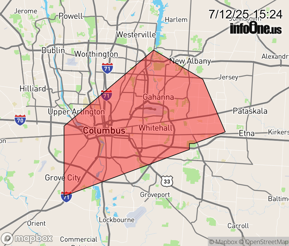 |
|||||||||
 Why aren't you using the InfoOne app? Why aren't you using the InfoOne app?
Stay abreast of information affecting your community! InfoOne tracks real-time information such as:
InfoOne currently supports over 100 communities in NC, VA and WV, and our coverage area is steadily growing. It's free! Install the InfoOne app today and see what you've been missing. |
|||||||||