|
|
Weather Alert |
| Washington County, OH | |||||||||
|
|
||||||||
|
Canceled 6/11/26 5:15 PM Special Weather Statement issued June 11 at 4:48PM EDT by NWS Charleston WV At 448 PM EDT, Doppler radar was tracking a strong thunderstorm near Belmont, or near St. Marys, moving east at 35 mph. HAZARD...Wind gusts up to 40 mph. SOURCE...Radar indicated. IMPACT...Gusty winds could knock down tree limbs and blow around unsecured objects. Locations impacted include... St. Marys, Middlebourne, Sistersville, Belmont, Newport, Matamoras, Friendly, Willow Island, Maxwell, Arvilla, Point Lookout, New Matamoras, Wick, Mountain, and Hebron. 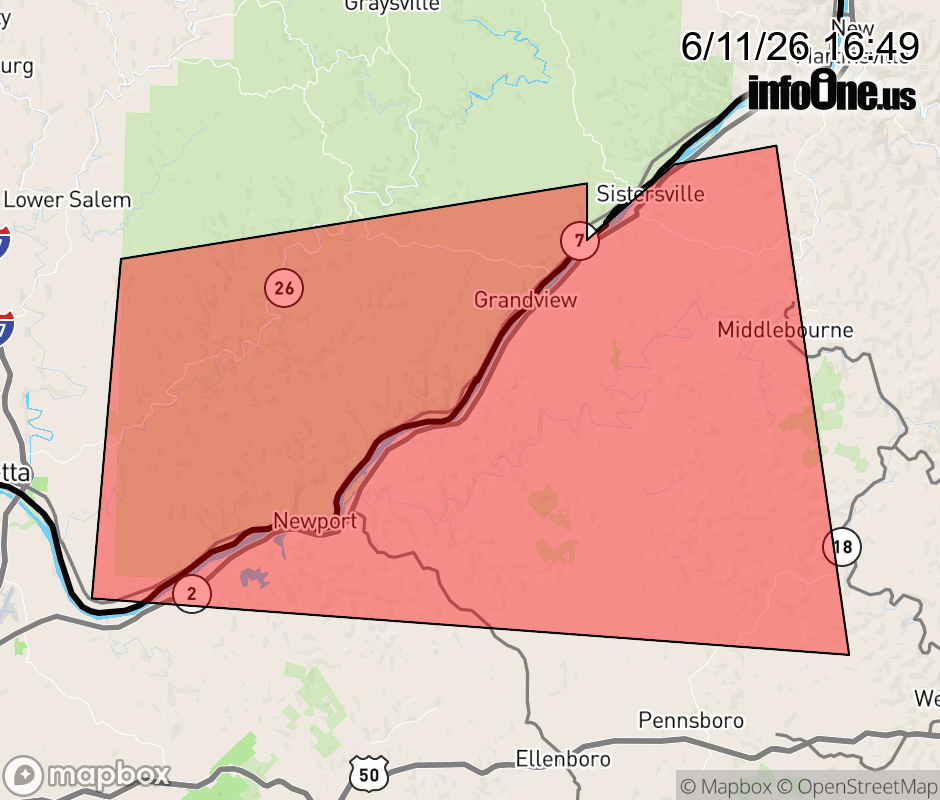 |
|||||||||
 Why aren't you using the InfoOne app? Why aren't you using the InfoOne app?
Stay abreast of information affecting your community! InfoOne tracks real-time information such as:
InfoOne currently supports over 100 communities in NC, VA and WV, and our coverage area is steadily growing. It's free! Install the InfoOne app today and see what you've been missing. |
|||||||||