|
|
Weather Alert |
| Gaston County, NC | |||||||||
|
|
||||||||
|
Canceled 7/20/24 11:24 PM Flash Flood Warning issued July 20 at 10:53PM EDT until July 21 at 1:30AM EDT by NWS Greenville-Spartanburg SC At 1053 PM EDT, Doppler radar and automated rain gauges indicated thunderstorms producing heavy rain along the I-85 corridor from Gastonia to Charlotte Between 3 and 4 inches of rain have fallen in a swath from Gastonia to Mount Holly. The expected rainfall rate is 2 to 3 inches in 1 hour. Additional rainfall amounts of 1 to 2 inches are possible in the warned area. Flash flooding is ongoing or expected to begin shortly. HAZARD...Life threatening flash flooding. Thunderstorms producing flash flooding. SOURCE...Radar and automated gauges. IMPACT...Life threatening flash flooding of creeks and streams, urban areas, highways, streets and underpasses. Some locations that will experience flash flooding include... Gastonia, Huntersville, Central Charlotte, Southwest Charlotte, Northeast Charlotte, Northwest Charlotte, Kings Mountain, Mt Holly, Belmont, Bessemer City, South Gastonia, Dallas, Stanley, Cramerton, Lowell, Ranlo, Mcadenville, Paw Creek, Charlotte Douglas Airport and Lake Wylie. 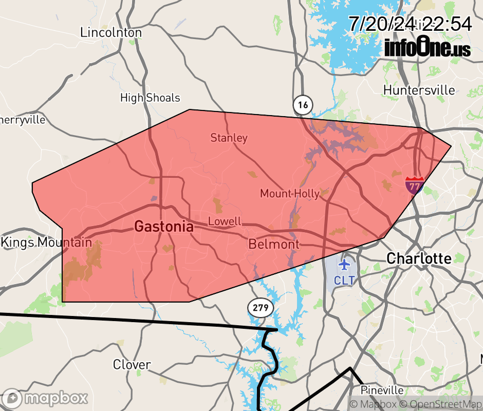 |
|||||||||
 Why aren't you using the InfoOne app? Why aren't you using the InfoOne app?
Stay abreast of information affecting your community! InfoOne tracks real-time information such as:
InfoOne currently supports over 100 communities in NC, VA and WV, and our coverage area is steadily growing. It's free! Install the InfoOne app today and see what you've been missing. |
|||||||||